Attēls:Wallingford castle ruins.jpg

Šī priekšskata izmērs: 800 × 324 pikseļi. Citi izmēri: 320 × 130 pikseļi | 640 × 259 pikseļi | 1 024 × 415 pikseļi | 1 280 × 518 pikseļi | 2 957 × 1 197 pikseļi.
Sākotnējais fails (2 957 × 1 197 pikseļi, faila izmērs: 654 KB, MIME tips: image/jpeg)
| Šis fails ir no Vikikrātuves. Tā apraksts no attēla lapas Vikikrātuvē ir parādīts zemāk. Vikikrātuve ir brīvi licencēta failu krātuve. Tu vari tai palīdzēt. |
Kopsavilkums
| Apraksts |
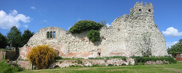
English: wallingford ( oxfordshire UK ) castle ruins remains of saint nicholas college |
| Datums | |
| Avots | Paša darbs |
| Autors | Pitou250 |
| Camera location | | View this and other nearby images on: OpenStreetMap |
|---|
Licence
| I, the copyright holder of this work, release this work into the public domain. This applies worldwide. In some countries this may not be legally possible; if so: I grant anyone the right to use this work for any purpose, without any conditions, unless such conditions are required by law. |
Faila hronoloģija
Uzklikšķini uz datums/laiks kolonnā esošās saites, lai apskatītos, kā šis fails izskatījās tad.
| Datums/Laiks | Attēls | Izmēri | Dalībnieks | Komentārs | |
|---|---|---|---|---|---|
| tagadējais | 2009. gada 26. aprīlis, plkst. 00.08 | 2 957 × 1 197 (654 KB) | Pitou250 | uploaded higher resolution version | |
| 2009. gada 25. aprīlis, plkst. 22.28 | 1 600 × 648 (359 KB) | Pitou250 | {{Information |Description={{en|1=wallingford ( oxfordshire UK ) castle ruins}} |Source=Own work by uploader |Author=Pitou250 |Date=2009-04-25 |Permission= |other_versions= }} {{Coor dms|51|36|6.5|N|1|7|19.4|W}} {{Location|51|36|6.5|N|1| |
Faila lietojums
Šo failu izmanto šajā 1 lapā:
Globālais faila lietojums
Šīs Vikipēdijas izmanto šo failu:
- Izmantojums azb.wikipedia.org
- Izmantojums ca.wikipedia.org
- Izmantojums ceb.wikipedia.org
- Izmantojums da.wikipedia.org
- Izmantojums de.wikipedia.org
- Izmantojums en.wikipedia.org
- Izmantojums en.wikibooks.org
- Izmantojums eo.wikipedia.org
- Izmantojums fr.wikipedia.org
- Izmantojums he.wikipedia.org
- Izmantojums it.wikipedia.org
- Izmantojums ko.wikipedia.org
- Izmantojums nl.wikipedia.org
- Izmantojums no.wikipedia.org
- Izmantojums pt.wikipedia.org
- Izmantojums ru.wikipedia.org
- Izmantojums simple.wikipedia.org
- Izmantojums sv.wikipedia.org
- Izmantojums tr.wikipedia.org
- Izmantojums uk.wikipedia.org
- Izmantojums www.wikidata.org