Attēls:SeaHebrides TheMinch map-fr.svg

Size of this PNG preview of this SVG file: 334 × 599 pikseļi. Citi izmēri: 134 × 240 pikseļi | 268 × 480 pikseļi | 428 × 768 pikseļi | 571 × 1 024 pikseļi | 1 142 × 2 048 pikseļi | 1 060 × 1 900 pikseļi.
Sākotnējais fails (SVG fails, definētais izmērs 1 060 × 1 900 pikseļi, faila izmērs: 914 KB)
| Šis fails ir no Vikikrātuves. Tā apraksts no attēla lapas Vikikrātuvē ir parādīts zemāk. Vikikrātuve ir brīvi licencēta failu krātuve. Tu vari tai palīdzēt. |
Kopsavilkums
| Apraksts | |||
| Datums | |||
| Avots | travail personnel, extrait de la carte Image:Scotland topographic map-fr.svg de Sting, sous licences GFDL et CC-BY-SA. | ||
| Autors | Sémhur | ||
| Citas versijas | |||
| Atsauce (required by the license) | © Sémhur / Wikimedia Commons / | ||
| SVG | W3C-validity not checked.
|
||
| Graphic Lab |

| Camera location | | View this and other nearby images on: OpenStreetMap |
|---|
Licence
Es, šī darba autortiesību īpašnieks, publicēju to saskaņā ar šīm licencēm:
| Copyleft: This work of art is free; you can redistribute it and/or modify it according to terms of the Free Art License. You will find a specimen of this license on the Copyleft Attitude site as well as on other sites. |
This file is licensed under the Creative Commons Attribution-Share Alike 4.0 International, 3.0 Unported, 2.5 Generic, 2.0 Generic and 1.0 Generic license.
- Jūs varat brīvi:
- koplietot – kopēt, izplatīt un pārraidīt darbu
- remiksēt – pielāgot darbu
- Saskaņā ar šādiem nosacījumiem:
- atsaucoties – Tev ir jānorāda autors, saite uz licenci un to, vai veiktas kādas izmaiņas. To var darīt jebkādā saprātīgā veidā, bet ne tādā, kas norādītu, ka licencētājs atbalsta tevi vai veidu, kā tu izmanto šo darbu.
- nemainot licenci – Ja tu miksē, pārveido vai izmanto materiālu, tev savs devums jāpublicē ar to pašu vai saderīgu licenci kā oriģināls.
Jūs varat izvēlēties licenci pēc jūsu vēlmes.
Faila hronoloģija
Uzklikšķini uz datums/laiks kolonnā esošās saites, lai apskatītos, kā šis fails izskatījās tad.
| Datums/Laiks | Attēls | Izmēri | Dalībnieks | Komentārs | |
|---|---|---|---|---|---|
| tagadējais | 2009. gada 1. septembris, plkst. 14.45 | | 1 060 × 1 900 (914 KB) | Sémhur | Fonts : Arial => DejaVu Sans Condensed, Times New Roman => DejaVu Serif Condensed. |
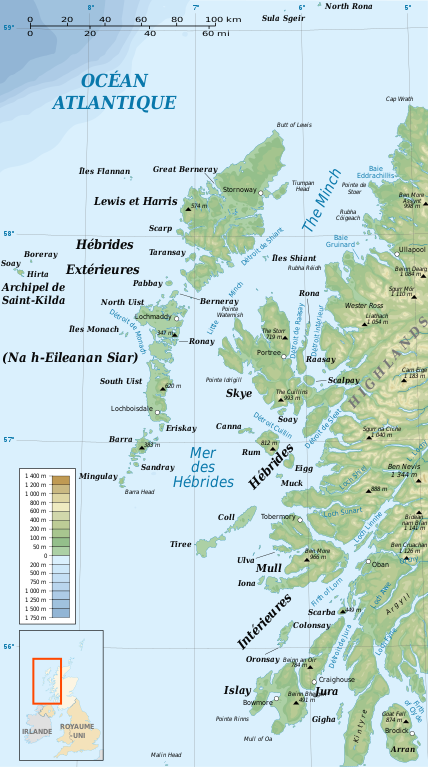
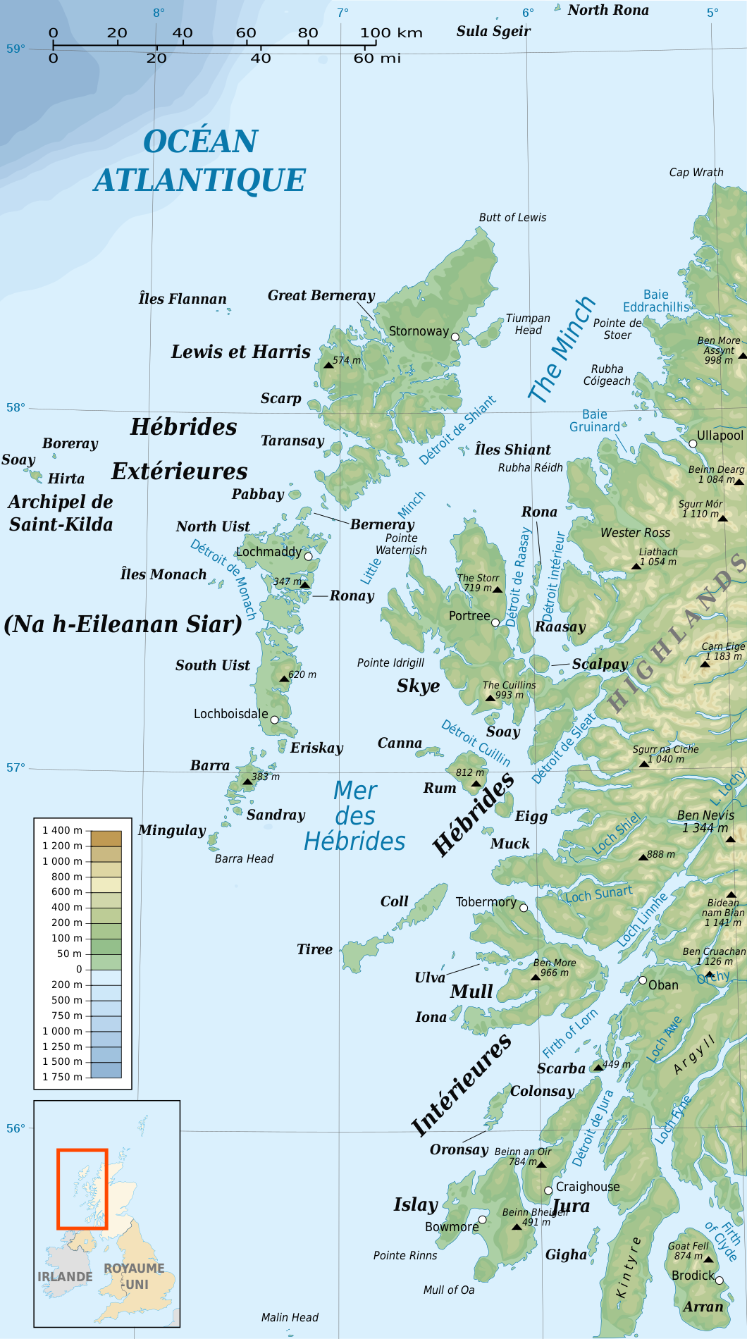
| 2008. gada 24. janvāris, plkst. 22.51 |  | 1 060 × 1 900 (936 KB) | Sémhur | {{Information |Description= {{en|French map of the Sea of the Hebrides and The Minch}} {{en|Carte de la Mer des Hébrides et de The Minch}} |Source=travail personnel |
Faila lietojums
Šo failu neizmanto nevienā lapā.
Globālais faila lietojums
Šīs Vikipēdijas izmanto šo failu:
- Izmantojums br.wikipedia.org
- Izmantojums ca.wikipedia.org
- Izmantojums cs.wikipedia.org
- Izmantojums es.wikipedia.org
- Izmantojums fr.wikipedia.org
- Izmantojums gl.wikipedia.org
- Izmantojums it.wikipedia.org
- Izmantojums pl.wikipedia.org
- Izmantojums pl.wiktionary.org
- Izmantojums pt.wikipedia.org
- Izmantojums sk.wikipedia.org