Attēls:Roman Empire 330 CE.png

Šī priekšskata izmērs: 800 × 428 pikseļi. Citi izmēri: 320 × 171 pikseļi | 640 × 343 pikseļi | 1 024 × 548 pikseļi | 1 280 × 685 pikseļi | 2 602 × 1 393 pikseļi.
Sākotnējais fails (2 602 × 1 393 pikseļi, faila izmērs: 270 KB, MIME tips: image/png)
| Šis fails ir no Vikikrātuves. Tā apraksts no attēla lapas Vikikrātuvē ir parādīts zemāk. Vikikrātuve ir brīvi licencēta failu krātuve. Tu vari tai palīdzēt. |

|
This historical map image could be re-created using vector graphics as an SVG file. This has several advantages; see Commons:Media for cleanup for more information. If an SVG form of this image is available, please upload it and afterwards replace this template with
{{vector version available|new image name}}.
It is recommended to name the SVG file “Roman Empire 330 CE.svg”—then the template Vector version available (or Vva) does not need the new image name parameter. |
Kopsavilkums
| Apraksts |
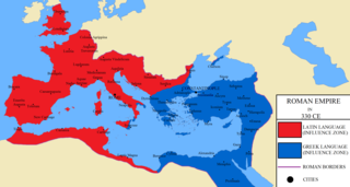
English: The Roman Empire was the post-Republican period of ancient Rome. As a polity it included large territorial holdings around the Mediterranean Sea in Europe, Northern Africa, and Western Asia ruled by emperors. |
| Datums | |
| Avots | Paša darbs |
| Autors | Doll91939 |
Licence
Es, šī darba autortiesību īpašnieks, publicēju to saskaņā ar šo licenci:
This file is licensed under the Creative Commons Attribution-Share Alike 4.0 International license.
- Jūs varat brīvi:
- koplietot – kopēt, izplatīt un pārraidīt darbu
- remiksēt – pielāgot darbu
- Saskaņā ar šādiem nosacījumiem:
- atsaucoties – Tev ir jānorāda autors, saite uz licenci un to, vai veiktas kādas izmaiņas. To var darīt jebkādā saprātīgā veidā, bet ne tādā, kas norādītu, ka licencētājs atbalsta tevi vai veidu, kā tu izmanto šo darbu.
- nemainot licenci – Ja tu miksē, pārveido vai izmanto materiālu, tev savs devums jāpublicē ar to pašu vai saderīgu licenci kā oriģināls.
Faila hronoloģija
Uzklikšķini uz datums/laiks kolonnā esošās saites, lai apskatītos, kā šis fails izskatījās tad.
| Datums/Laiks | Attēls | Izmēri | Dalībnieks | Komentārs | |
|---|---|---|---|---|---|
| tagadējais | 2020. gada 21. septembris, plkst. 04.51 | | 2 602 × 1 393 (270 KB) | Doll91939 | Uploaded own work with UploadWizard |
Faila lietojums
Šo failu izmanto šajā 1 lapā:
Globālais faila lietojums
Šīs Vikipēdijas izmanto šo failu:
- Izmantojums bn.wikipedia.org
- Izmantojums en.wikipedia.org
- Izmantojums fi.wikipedia.org
- Izmantojums fr.wikipedia.org
- Izmantojums it.wikipedia.org
- Izmantojums pl.wikipedia.org
- Izmantojums pt.wikipedia.org
- Izmantojums sr.wikipedia.org
- Izmantojums uk.wikipedia.org
- Izmantojums vi.wikipedia.org
- Izmantojums zh.wikipedia.org