Attēls:Karte Deutschland.png
Augstāka izšķirtspēja nav pieejama.
Karte_Deutschland.png (188 × 235 pikseļi, faila izmērs: 2 KB, MIME tips: image/png)
| Šis fails ir no Vikikrātuves. Tā apraksts no attēla lapas Vikikrātuvē ir parādīts zemāk. Vikikrātuve ir brīvi licencēta failu krātuve. Tu vari tai palīdzēt. |
| Apraksts |
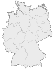
English: Map of Germany with the borders of the 16 federal states.
Deutsch: Karte von Deutschland mit den Grenzen der 16 Bundesländer. |
| Datums | Nezināms datums |
| Avots | OpenGeoDB |
| Autors | NN/OpenGeoDB |
| Atļauja: (Šī faila izmantošana citur) |
GFDL |
This image was generated with OpenGeoDB. The information there is placed in the public domain, images generated from OpenGeoDB are derivative works without passing the threshold of creativity, they are therefore also public domain.
| This work is ineligible for copyright and therefore in the public domain because it consists entirely of information that is common property and contains no original authorship. |

|
File:Germany location map.svg is a vector version of this file. It should be used in place of this PNG file when not inferior.
File:Karte Deutschland.png → File:Germany location map.svg
For more information, see Help:SVG. |
 |
Faila hronoloģija
Uzklikšķini uz datums/laiks kolonnā esošās saites, lai apskatītos, kā šis fails izskatījās tad.


Faila lietojums
Šo failu neizmanto nevienā lapā.
Globālais faila lietojums
Šīs Vikipēdijas izmanto šo failu:
- Izmantojums ceb.wikipedia.org
- Izmantojums da.wikipedia.org
- Izmantojums de.wikipedia.org
- Izmantojums nds.wikipedia.org
- Landkreis Emsland
- Landkreis Rodenborg (Wümm)
- Landkreis Stood
- Landkreis Heidkreis
- Landkreis Vechte
- Landkreis Veern
- Kreis Noordfreesland
- Landkreis Cuxhoben
- Landkreis Oosterholt
- Landkreis Horborg
- Landkreis Lümborg
- Kreis Pinnbarg
- Landkreis Ollnborg
- Kreis Steenborg
- Landkreis Weißenburg-Gunzenhausen
- Landkreis Würzburg
- Landkreis Wunsiedel im Fichtelgebirge
- Landkreis Weilheim-Schongau
- Landkreis Unterallgäu
- Landkreis Traunstein
- Landkreis Tirschenreuth
- Landkreis Straubing-Bogen
- Landkreis Starnberg
- Landkreis Schweinfurt
- Landkreis Schwandorf
- Landkreis Rottal-Inn
- Landkreis Roth
- Landkreis Rosenheim
- Landkreis Rhön-Grabfeld
- Landkreis Paane
- Landkreis Wulfenbüttel
- Landkreis Groafschup Bentem
- Landkreis Hameln-Purmunt
- Landkreis Aichach-Friedberg
- Landkreis Altötting
- Landkreis Amberg-Sulzbach
- Landkreis Schaumborg
- Landkreis Ülzen
- Landraodsamt Stemmert
- Izmantojums pms.wikipedia.org
Skatīt šī faila pilno globālo izmantojumu.