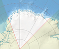
Attēls:Dronning Maud Land location map.png

Šī priekšskata izmērs: 721 × 600 pikseļi. Citi izmēri: 289 × 240 pikseļi | 577 × 480 pikseļi | 749 × 623 pikseļi.
Sākotnējais fails (749 × 623 pikseļi, faila izmērs: 573 KB, MIME tips: image/png)
Kopsavilkums labot šo sadaļu
| Apraksts |
Description missing. Files should have a summary to inform others of the content. If you know or have access to such information, please add it to the file page. |
|---|---|
| Avots | Source missing. Files should have a source (for example own photo). If you know or have access to such information, please add it to the file page. |
| Datums | |
| Autors | Author missing. Files should have an author (for example user name). If you know or have access to such information, please add it to the file page. |
| Atļauja (reusing this file) |
Skatīt tālāk
|
Licence labot šo sadaļu
I, the copyright holder of this work, hereby publish it under the following license:
|
Faila hronoloģija
Uzklikšķini uz datums/laiks kolonnā esošās saites, lai apskatītos, kā šis fails izskatījās tad.
| Datums/Laiks | Attēls | Izmēri | Dalībnieks | Komentārs | |
|---|---|---|---|---|---|
| tagadējais | 2011. gada 4. februāris, plkst. 00.45 |  | 749 × 623 (573 KB) | Kikos (diskusija | devums) | cropped |
| 2011. gada 3. februāris, plkst. 19.53 |  | 999 × 623 (766 KB) | Kikos (diskusija | devums) | {{self|cc-by-sa-3.0}} Kategorija:Antarktīdas kartes |
Šo failu nevar pārrakstīt.
Faila lietojums
Šo failu izmanto šajās 3 lapās: