Attēls:Byylot summer 2012.jpg

Augstāka izšķirtspēja nav pieejama.
Byylot_summer_2012.jpg (720 × 480 pikseļi, faila izmērs: 118 KB, MIME tips: image/jpeg)
| Šis fails ir no Vikikrātuves. Tā apraksts no attēla lapas Vikikrātuvē ir parādīts zemāk. Vikikrātuve ir brīvi licencēta failu krātuve. Tu vari tai palīdzēt. |
| Apraksts |
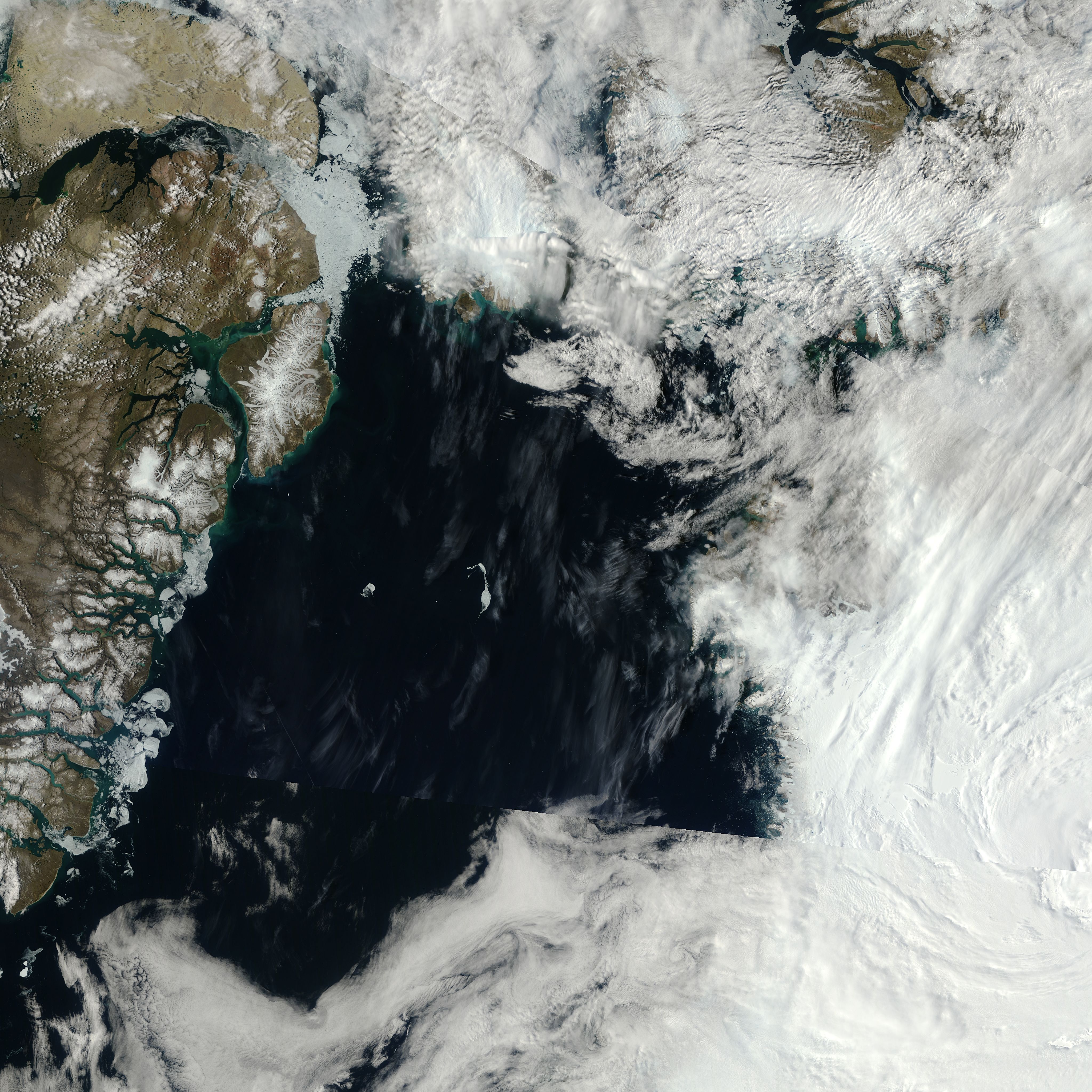
English: Part of the Canadian Arctic Archipelago, Bylot Island is a 11,000-square-kilometer (4,200-square-mile) island within Canada’s Sirmilik National Park. In wintertime, snow and ice blanket the island in white, but in summertime, Bylot’s glaciers contrast with its earth-toned land cover. The Moderate Resolution Imaging Spectroradiometer (MODIS) on NASA’s Terra satellite observed Bylot Island on March 9, 2012 (top), and July 22, 2012 (bottom) |
|||||
| Datums | acquired July 22, 2012 | |||||
| Avots | http://earthobservatory.nasa.gov/IOTD/view.php?id=79813&src=eoa-iotd | |||||
| Autors | NASA, MODIS on NASA’s Terra satellite | |||||
| Atļauja: (Šī faila izmantošana citur) |
|
|||||
| Citas versijas | Larger image |

Faila hronoloģija
Uzklikšķini uz datums/laiks kolonnā esošās saites, lai apskatītos, kā šis fails izskatījās tad.
| Datums/Laiks | Attēls | Izmēri | Dalībnieks | Komentārs | |
|---|---|---|---|---|---|
| tagadējais | 2012. gada 14. decembris, plkst. 07.52 | | 720 × 480 (118 KB) | Tillman | {{Information |Description ={{en|1=Part of the Canadian Arctic Archipelago, Bylot Island is a 11,000-square-kilometer (4,200-square-mile) island within Canada’s Sirmilik National Park. In wintertime, snow and ice blanket the island in white, but i... |
Faila lietojums
Šo failu izmanto šajā 1 lapā:
Globālais faila lietojums
Šīs Vikipēdijas izmanto šo failu:
- Izmantojums af.wikipedia.org
- Izmantojums bg.wikipedia.org
- Izmantojums el.wikipedia.org
- Izmantojums en.wikipedia.org
- Izmantojums es.wikipedia.org
- Izmantojums fa.wikipedia.org
- Izmantojums ml.wikipedia.org
- Izmantojums pl.wikipedia.org
- Izmantojums sl.wikipedia.org
- Izmantojums sw.wikipedia.org