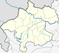
Attēls:Austria Upper Austria relief location map.png

Šī priekšskata izmērs: 678 × 600 pikseļi. Citi izmēri: 271 × 240 pikseļi | 543 × 480 pikseļi | 868 × 768 pikseļi | 1 158 × 1 024 pikseļi | 2 513 × 2 223 pikseļi.
Sākotnējais fails (2 513 × 2 223 pikseļi, faila izmērs: 6,3 MB, MIME tips: image/png)
Faila hronoloģija
Uzklikšķini uz datums/laiks kolonnā esošās saites, lai apskatītos, kā šis fails izskatījās tad.
| Datums/Laiks | Attēls | Izmēri | Dalībnieks | Komentārs | |
|---|---|---|---|---|---|
| tagadējais | 2019. gada 4. novembris, plkst. 12.25 |  | 2 513 × 2 223 (6,3 MB) | Tschubby | == {{int:filedesc}} == {{Information |Description={{de|1=Positionskarte von Oberösterreich Quadratische Plattkarte. Geographische Begrenzung der Karte: * N: 48.78063° N * S: 47.44388° N * W: 12.73041° O * O: 15.00183° O}} {{en|1=Location map of {{W|Upper Austria}} Equirectangular projection. Geographic limits of the map: * N: 48.78063° N * S: 47.44388° N * W: 12.73041° E * E: 15.00183° E}} |Source=Own work, based on [[:file:Austria Upper Austria location map.svg|Austria... |
Faila lietojums
Šo failu izmanto šajā 1 lapā:
Globālais faila lietojums
Šīs Vikipēdijas izmanto šo failu:
- Izmantojums bg.wikipedia.org
- Izmantojums de.wikipedia.org
- Traunsee
- Bernaschek-Insel
- Traunstein (Berg)
- Attersee
- Mondsee (See)
- Hallstätter See
- Almsee
- Pöstlingberg
- Brunnkogel (Höllengebirge, 1708 m)
- Eferdinger Becken
- Irrsee
- Großer Priel
- Prielschutzhaus
- Warscheneck
- Gosauseen
- Kasberg
- Gleinkersee
- Oedter See
- Offensee
- Laudachsee
- Pichlinger See
- Pleschinger See
- Schwarzensee (St. Wolfgang)
- Nussensee
- Großer Ödsee
- Kleiner Ödsee
- Speicherkraftwerk Partenstein
- Adamekhütte
- Almtal
- Dümlerhütte
- Attergau
- Feuerkogel (Höllengebirge)
- Sternstein
Skatīt šī faila pilno globālo izmantojumu.

