Attēls:Wales Wrexham locator map.svg

Size of this PNG preview of this SVG file: 502 × 600 pikseļi. Citi izmēri: 201 × 240 pikseļi | 402 × 480 pikseļi | 643 × 768 pikseļi | 857 × 1 024 pikseļi | 1 714 × 2 048 pikseļi | 1 047 × 1 251 pikseļi.
Sākotnējais fails (SVG fails, definētais izmērs 1 047 × 1 251 pikseļi, faila izmērs: 147 KB)
| Šis fails ir no Vikikrātuves. Tā apraksts no attēla lapas Vikikrātuvē ir parādīts zemāk. Vikikrātuve ir brīvi licencēta failu krātuve. Tu vari tai palīdzēt. |
Kopsavilkums
| Apraksts |
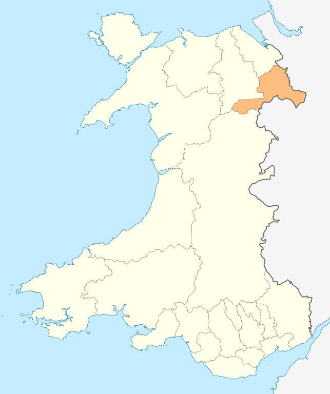
Deutsch: Lagekarte von Wrexham in Wales
English: Locator map of Wrexham in Wales |
| Datums | |
| Avots | Paša darbs |
| Autors | NordNordWest |
| Atļauja: (Šī faila izmantošana citur) |
Es, šī darba autortiesību īpašnieks, publicēju to saskaņā ar šo licenci: Šis fails tiek izplatīts saskaņā ar licences Creative Commons Atsauce-Līdzīgi Noteikumi 3.0 Vispārējiem noteikumiem.
|

|
Šī karte bija uzlabota vācu Kartenwerkstatt. Jūs arī varat piedāvāt citas kartes uzlabošanai.
|
Faila hronoloģija
Uzklikšķini uz datums/laiks kolonnā esošās saites, lai apskatītos, kā šis fails izskatījās tad.
| Datums/Laiks | Attēls | Izmēri | Dalībnieks | Komentārs | |
|---|---|---|---|---|---|
| tagadējais | 2010. gada 4. maijs, plkst. 22.00 | | 1 047 × 1 251 (147 KB) | NordNordWest | {{int:filedesc}} {{Information |Description= {{de|Lagekarte von Wrexham in Wales}} {{en|Locator map of Wrexham in Wales}} |Source={{Own}} |Date=2010-05-04 |Author={{U|NordNordWest}} |Permission={{self|cc-by-sa-3.0}} |other_versions= }} {{Kartenwerkstatt} |
Faila lietojums
Šo failu izmanto šajā 1 lapā:
Globālais faila lietojums
Šīs Vikipēdijas izmanto šo failu:
- Izmantojums en.wikipedia.org
- Berwyn range
- Wrexham
- Bangor-on-Dee
- Pontcysyllte Aqueduct
- Chirk
- Maelor
- English Maelor
- Wrexham County Borough
- Wrexham University
- Glyn Valley Tramway
- Rhosllanerchrugog
- Ruabon
- Rhosrobin
- All Saints' Church, Gresford
- Overton-on-Dee
- Coedpoeth
- Chirk Castle
- Chirk Aqueduct
- Fenn's, Whixall and Bettisfield Mosses National Nature Reserve
- St Giles' Church, Wrexham
- Holt, Wrexham
- Acrefair
- Ceiriog Valley
- Gresford
- Cadair Bronwen
- Acton, Wrexham
- Abenbury
- Wrexham Industrial Estate
- Wrexham Lager
- Erddig
- Croes Newydd
- River Clywedog
- Minera
- River Alyn
- Wynn Hall
- Bwlchgwyn
- Cefn Mawr
- Marford
- Bersham Ironworks
- Burton, Wrexham
- Template:Wrexham-geo-stub
- Glyn Ceiriog
- Pontfadog
- Ponciau
- Rossett
- Moss Valley, Wrexham
- Brymbo
- Pen-y-cae, Wrexham
- Erbistock
- Pentre Bychan
Skatīt šī faila pilno globālo izmantojumu.