Attēls:Strait of Gibraltar 5.53940W 35.97279N.jpg

Šī priekšskata izmērs: 800 × 599 pikseļi. Citi izmēri: 320 × 240 pikseļi | 640 × 479 pikseļi | 1 024 × 766 pikseļi | 1 280 × 958 pikseļi.
Sākotnējais fails (1 280 × 958 pikseļi, faila izmērs: 178 KB, MIME tips: image/jpeg)
| Šis fails ir no Vikikrātuves. Tā apraksts no attēla lapas Vikikrātuvē ir parādīts zemāk. Vikikrātuve ir brīvi licencēta failu krātuve. Tu vari tai palīdzēt. |
Kopsavilkums
| Apraksts |
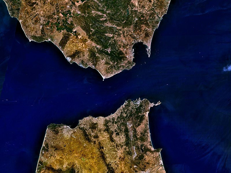
English: The Strait of Gibraltar |
| Datums | 2005. gada 15. maijs (upload date) |
| Avots | Satellite imagery taken by screenshot from NASA World Wind software |
| Autors | NASA |
| Object location | | View this and other nearby images on: OpenStreetMap |
|---|
Licence
| This image is in the public domain because it is a screenshot from NASA’s globe software World Wind using a public domain layer, such as Blue Marble, MODIS, Landsat, SRTM, USGS or GLOBE.
|
 |
| Annotations | This image is annotated: View the annotations at Commons |
Faila hronoloģija
Uzklikšķini uz datums/laiks kolonnā esošās saites, lai apskatītos, kā šis fails izskatījās tad.
| Datums/Laiks | Attēls | Izmēri | Dalībnieks | Komentārs | |
|---|---|---|---|---|---|
| tagadējais | 2005. gada 15. maijs, plkst. 18.32 | | 1 280 × 958 (178 KB) | Rex | NASA World Wind screenshot. {{PD-USGov-NASA}} Category:Seas |
Faila lietojums
Šo failu neizmanto nevienā lapā.
Globālais faila lietojums
Šīs Vikipēdijas izmanto šo failu:
- Izmantojums arz.wikipedia.org
- Izmantojums ast.wikipedia.org
- Izmantojums ban.wikipedia.org
- Izmantojums ba.wikipedia.org
- Izmantojums bs.wikipedia.org
- Izmantojums ceb.wikipedia.org
- Izmantojums cv.wikipedia.org
- Izmantojums de.wikipedia.org
- Izmantojums en.wikipedia.org
- Izmantojums en.wiktionary.org
- Izmantojums es.wikipedia.org
- Izmantojums eu.wikipedia.org
- Izmantojums fi.wikipedia.org
- Izmantojums fr.wikipedia.org
- Izmantojums fr.wikivoyage.org
- Izmantojums fr.wiktionary.org
- Izmantojums gl.wiktionary.org
- Izmantojums ia.wikipedia.org
- Izmantojums id.wikipedia.org
- Izmantojums id.wiktionary.org
- Izmantojums is.wikipedia.org
- Izmantojums it.wikipedia.org
- Izmantojums jv.wikipedia.org
- Izmantojums ko.wikipedia.org
- Izmantojums ky.wikipedia.org
- Izmantojums mg.wikipedia.org
- Izmantojums min.wikipedia.org
- Izmantojums ms.wikipedia.org
Skatīt šī faila pilno globālo izmantojumu.