Attēls:Sierra Leone location map.svg

Size of this PNG preview of this SVG file: 600 × 600 pikseļi. Citi izmēri: 240 × 240 pikseļi | 480 × 480 pikseļi | 768 × 768 pikseļi | 1 024 × 1 024 pikseļi | 2 048 × 2 048 pikseļi | 1 607 × 1 607 pikseļi.
Sākotnējais fails (SVG fails, definētais izmērs 1 607 × 1 607 pikseļi, faila izmērs: 244 KB)
| Šis fails ir no Vikikrātuves. Tā apraksts no attēla lapas Vikikrātuvē ir parādīts zemāk. Vikikrātuve ir brīvi licencēta failu krātuve. Tu vari tai palīdzēt. |
| Apraksts |
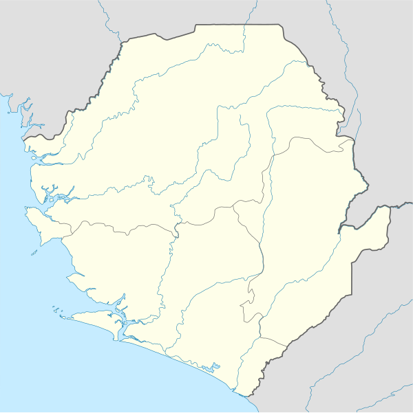
Deutsch: Positionskarte von Sierra Leone
Quadratische Plattkarte. Geographische Begrenzung der Karte:
English: Location map of Sierra Leone
Equirectangular projection. Geographic limits of the map:
|
|||
| Datums | 2008. gada 10. decembris (upload date) | |||
| Avots |
own work, using
|
|||
| Autors | NordNordWest | |||
| Atļauja: (Šī faila izmantošana citur) |
|
|||
| Citas versijas |
Derivative works of this file: |


|
Šī karte bija uzlabota vācu Kartenwerkstatt. Jūs arī varat piedāvāt citas kartes uzlabošanai.
|
Faila hronoloģija
Uzklikšķini uz datums/laiks kolonnā esošās saites, lai apskatītos, kā šis fails izskatījās tad.
| Datums/Laiks | Attēls | Izmēri | Dalībnieks | Komentārs | |
|---|---|---|---|---|---|
| tagadējais | 2008. gada 10. decembris, plkst. 22.39 | | 1 607 × 1 607 (244 KB) | NordNordWest | {{Information |Description= {{de|Positionskarte von Sierra Leone}} Quadratische Plattkarte. Geographische Begrenzung der Karte: * N: 10.2° N * S: 6.8° N * W: 13.5° W * O: 10.1° W {{en|Location map of [[:en:Sierra Leone|Sierra Leon |
Faila lietojums
Šo failu izmanto šajās 4 lapās:
Globālais faila lietojums
Šīs Vikipēdijas izmanto šo failu:
- Izmantojums af.wikipedia.org
- Izmantojums am.wikipedia.org
- Izmantojums an.wikipedia.org
- Izmantojums ar.wikipedia.org
- Izmantojums az.wikipedia.org
- Izmantojums be-tarask.wikipedia.org
- Izmantojums be.wikipedia.org
- Izmantojums bg.wikipedia.org
- Izmantojums bn.wikipedia.org
- Izmantojums bs.wikipedia.org
- Izmantojums ceb.wikipedia.org
Skatīt šī faila pilno globālo izmantojumu.