Attēls:SVK Tatry.svg

Size of this PNG preview of this SVG file: 800 × 396 pikseļi. Citi izmēri: 320 × 158 pikseļi | 640 × 316 pikseļi | 1 024 × 506 pikseļi | 1 280 × 633 pikseļi | 2 560 × 1 266 pikseļi | 811 × 401 pikseļi.
Sākotnējais fails (SVG fails, definētais izmērs 811 × 401 pikseļi, faila izmērs: 5,12 MB)
| Šis fails ir no Vikikrātuves. Tā apraksts no attēla lapas Vikikrātuvē ir parādīts zemāk. Vikikrātuve ir brīvi licencēta failu krātuve. Tu vari tai palīdzēt. |
| Apraksts |
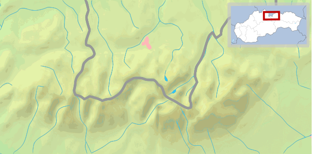
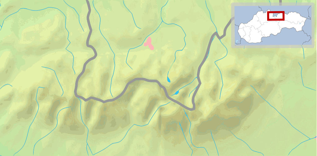
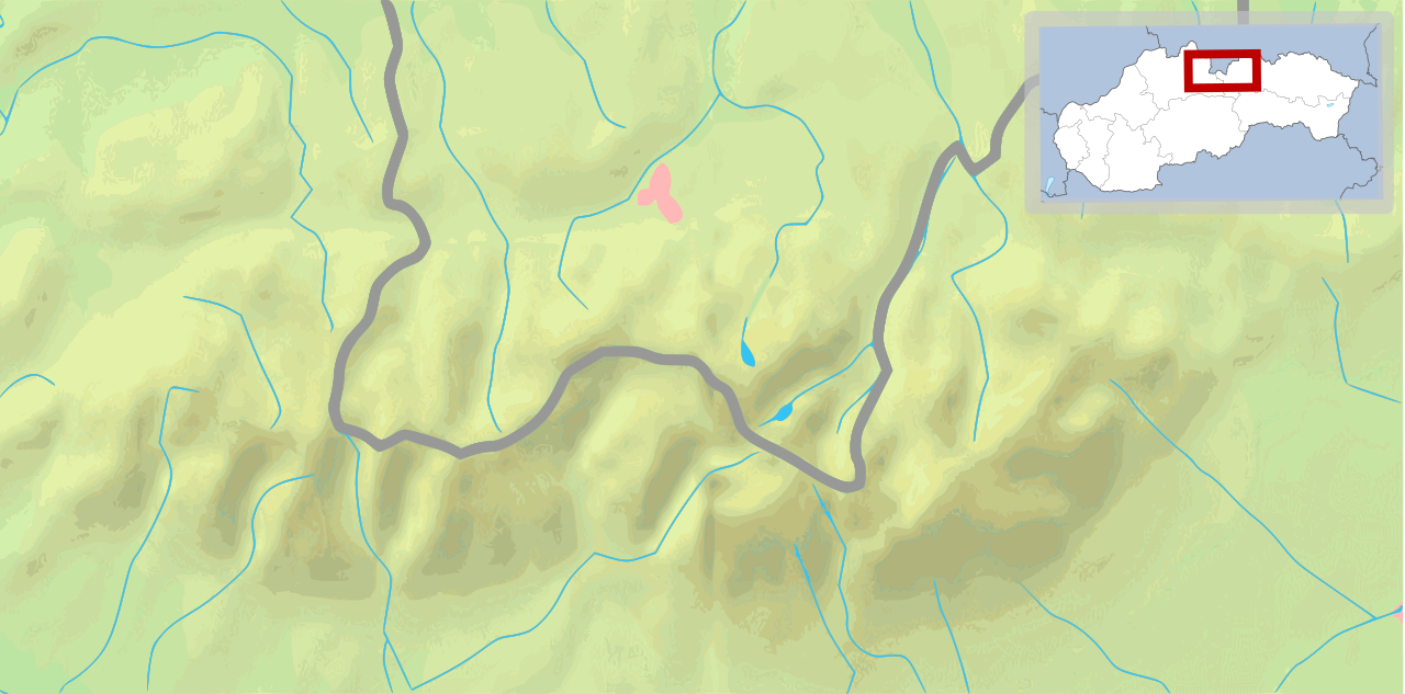
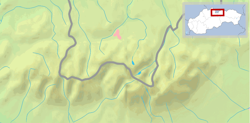
English: Map of the Tatra Mountains Polski: Mapa Tatr |
||
| Datums | (UTC) | ||
| Avots | |||
| Autors |
|
||
| Citas versijas |
File:POL Tatry.svg:  |
||
| SVG veidošana |
|


Šis fails tiek izplatīts saskaņā ar licences Creative Commons Atsauce-Līdzīgi Noteikumi 3.0 Vispārējiem noteikumiem.
- Jūs varat brīvi:
- koplietot – kopēt, izplatīt un pārraidīt darbu
- remiksēt – pielāgot darbu
- Saskaņā ar šādiem nosacījumiem:
- atsaucoties – Tev ir jānorāda autors, saite uz licenci un to, vai veiktas kādas izmaiņas. To var darīt jebkādā saprātīgā veidā, bet ne tādā, kas norādītu, ka licencētājs atbalsta tevi vai veidu, kā tu izmanto šo darbu.
- nemainot licenci – Ja tu miksē, pārveido vai izmanto materiālu, tev savs devums jāpublicē ar to pašu vai saderīgu licenci kā oriģināls.
Original upload log
This image is a derivative work of the following images:
- File:Tatry mapa 2.png licensed with PD-Demis
- 2008-09-02T21:41:25Z ToSter 811x401 (305387 Bytes) {{Information |Description={{en|1=Map of the Tatra Mountains}} {{pl|1=Mapa Tatr}} |Source=PD map from Demis - modified version of [[:Image:Tatry mapa.png]] by [[User:Botev]] |Author=[[User:ToSter|ToSter]] |Date=Sep 2nd, 2008
- File:Poland location map white.svg licensed with Cc-by-sa-3.0, Cc-by-sa-3.0/en
- 2009-01-29T00:51:50Z Mareklug 862x838 (358904 Bytes) {{Information |Description={{de| Positionskarte von Polen auf weissem Hintergrund. Quadratische Plattkarte, N-S-Streckung 160 %. Geographische Begrenzung der Karte: * N: 55.2° N * S: 48.7° N * W: 13.8° O * O: 24.5° O {{en
Uploaded with derivativeFX
Faila hronoloģija
Uzklikšķini uz datums/laiks kolonnā esošās saites, lai apskatītos, kā šis fails izskatījās tad.
| Datums/Laiks | Attēls | Izmēri | Dalībnieks | Komentārs | |
|---|---|---|---|---|---|
| tagadējais | 2009. gada 11. februāris, plkst. 13.27 | | 811 × 401 (5,12 MB) | Mareklug | pozycjonowanie w górnym rogu na życzenie, ramka (subtelna, półprzezroczysta) / positioning in upper corner on request, border (a suttle, semi-transparent one) |
| 2009. gada 11. februāris, plkst. 06.14 |  | 811 × 401 (5,12 MB) | Mareklug | pozycjonowanie mapki Slowacji aby nie zakrywala Tatr :) Moze byc tak nietypowo, pod katem? I dodanie prostokaciku czerwonego dla orientacji. / positioning of the map of Slovakia so that it does not cover up the Tatra mountains themselves :) Is this accept | |
| 2009. gada 10. februāris, plkst. 18.10 |  | 811 × 401 (5,12 MB) | Mareklug | {{Information |Description={{en|1=Map of Tatra Mountains, with an inset of the map of Slovakia}} {{pl|1=Mapa Tatr, z wkladem malej mapki Slowacji}} |Source=own work, derivative work |Author=Mareklug |Date=2009-02-11 |Permission= |other_versions= }} <!--{ |
Faila lietojums
Šo failu neizmanto nevienā lapā.
Globālais faila lietojums
Šīs Vikipēdijas izmanto šo failu:
- Izmantojums en.wikivoyage.org
- Izmantojums es.wikipedia.org
- Izmantojums fi.wikipedia.org
- Izmantojums fi.wikivoyage.org
- Izmantojums fr.wikipedia.org
- Izmantojums is.wikipedia.org
- Izmantojums pl.wikipedia.org
- Gerlach
- Hawrań
- Zdziarska Przełęcz
- Młynarz (Tatry)
- Ganek (Tatry)
- Wysoka (Tatry)
- Smoczy Szczyt
- Ciężki Szczyt
- Waga (Tatry)
- Batyżowiecki Szczyt
- Kościołek
- Rumanowy Szczyt
- Żłobisty Szczyt
- Zmarzły Szczyt
- Kaczy Szczyt
- Kończysta
- Zadni Gerlach
- Litworowy Szczyt
- Polski Grzebień
- Mała Wysoka
- Rohatka
- Staroleśny Szczyt
- Sławkowski Szczyt
- Dzika Turnia
- Świstowy Szczyt
- Jaworowy Szczyt
- Mały Jaworowy Szczyt
- Ostry Szczyt
- Mały Lodowy Szczyt
- Szeroka Jaworzyńska
- Czerwona Ławka
- Lodowa Przełęcz
- Lodowy Szczyt
- Baranie Rogi
- Durny Szczyt
- Mały Durny Szczyt
- Łomnica (Tatry)
- Widły (Tatry)
- Kieżmarski Szczyt
- Huncowski Szczyt
- Mały Kieżmarski Szczyt
- Rakuska Czuba
- Czarny Szczyt
- Kołowy Szczyt
Skatīt šī faila pilno globālo izmantojumu.