Attēls:Relief Map of Germany.svg

Sākotnējais fails (SVG fails, definētais izmērs 1 073 × 1 272 pikseļi, faila izmērs: 6,54 MB)
| Šis fails ir no Vikikrātuves. Tā apraksts no attēla lapas Vikikrātuvē ir parādīts zemāk. Vikikrātuve ir brīvi licencēta failu krātuve. Tu vari tai palīdzēt. |
Kopsavilkums
| Apraksts |
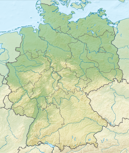
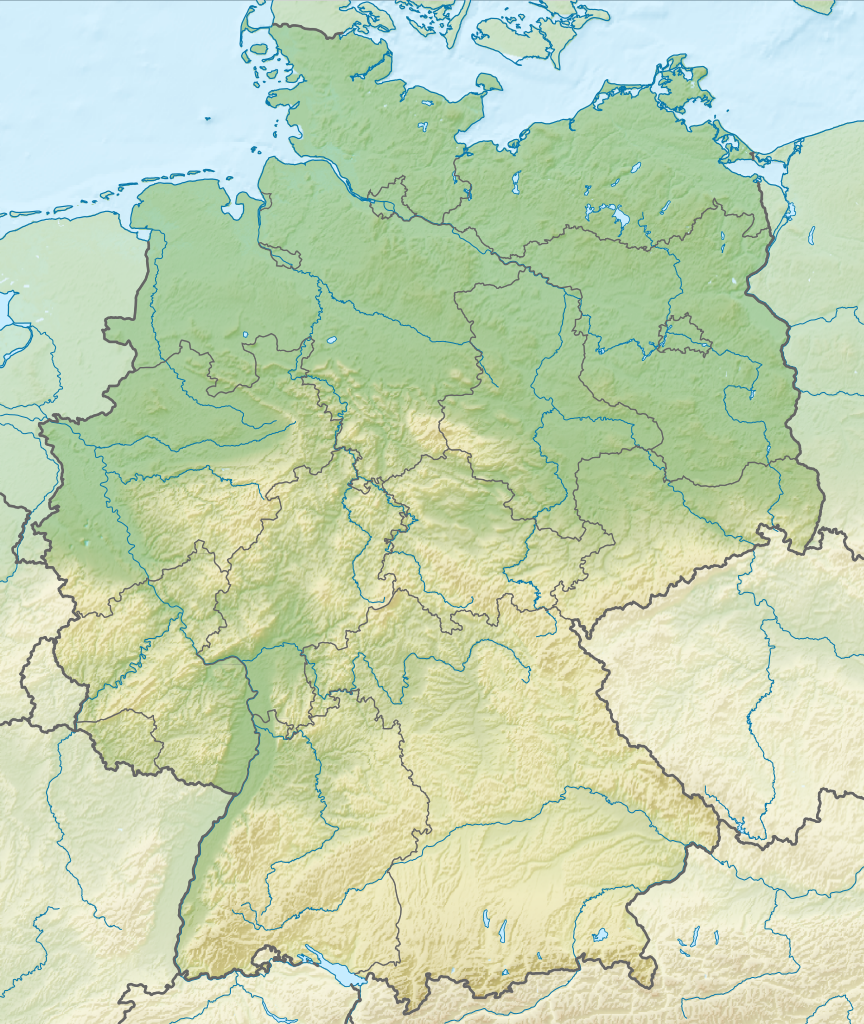
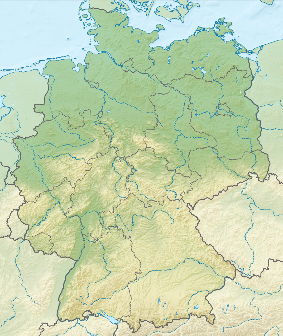
Deutsch: Positionskarte von Deutschland mit Gewässern
Quadratische Plattkarte, N-S-Streckung 150 %. Geographische Begrenzung der Karte:
English: Location map of Germany with waterbodies
Equirectangular projection, N/S stretching 150 %. Geographic limits of the map:
|
| Datums | |
| Avots |
Paša darbs This vector image includes elements that have been taken or adapted from this file: This vector image includes elements that have been taken or adapted from this file: |
| Autors |
TUBS |
| Citas versijas |
Bundesrepublik Deutschland (vor 1990 nur West-Deutschland):
Deutsche Demokratische Republik (mit BRD im Ausschnitt):
Ostdeutschland (vor 1990 Deutsche Demokratische Republik):
Deutschland zwischen Mai 1945 und Oktober 1949:
Thematisch:
Deutsches Reich (1918–1945) (best used with this template (de)):
|
| SVG veidošana |


_23_May_1949_-_6_Oct_1949.svg)


_location_map.svg)
_location_map_2013.svg)


Licence
- Jūs varat brīvi:
- koplietot – kopēt, izplatīt un pārraidīt darbu
- remiksēt – pielāgot darbu
- Saskaņā ar šādiem nosacījumiem:
- atsaucoties – Tev ir jānorāda autors, saite uz licenci un to, vai veiktas kādas izmaiņas. To var darīt jebkādā saprātīgā veidā, bet ne tādā, kas norādītu, ka licencētājs atbalsta tevi vai veidu, kā tu izmanto šo darbu.
- nemainot licenci – Ja tu miksē, pārveido vai izmanto materiālu, tev savs devums jāpublicē ar to pašu vai saderīgu licenci kā oriģināls.

|
I'd greatly appreciate, that you attribute this media file to Wikimedia Commons, if used outside Wikipedia or Commons. For use in publications such as books, newspapers, blogs, websites, please insert here the following line:
|
Faila hronoloģija
Uzklikšķini uz datums/laiks kolonnā esošās saites, lai apskatītos, kā šis fails izskatījās tad.
| Datums/Laiks | Attēls | Izmēri | Dalībnieks | Komentārs | |
|---|---|---|---|---|---|
| tagadējais | 2011. gada 1. decembris, plkst. 17.00 | | 1 073 × 1 272 (6,54 MB) | TUBS |
Faila lietojums
Šo failu izmanto šajās 63 lapās:
- Allere
- Ammerezers
- Aula Palatina
- Berhtesgādenes Alpi
- Bodenezers
- Brīgaha
- Cūgšpice
- Dimmers
- Dollarts
- Eifels (kalni)
- Emsa
- Feldbergs (kalns)
- Fēmarna
- Fēmarnbelts
- Greifsvaldes līcis
- Hedebija
- Helgolande
- Hidenzē
- Hohvanners
- Hāfele
- Ismaningas ūdenskrātuve
- Izāra
- Kummerovas ezers
- Kēnigszē
- Kīmezers
- Leha (upe)
- Leine
- Loizaha
- Lāheras ezers
- Lāna (upe)
- Lībekas līcis
- Mainava
- Mindelezers
- Mozele
- Mēklenburgas līcis
- Mīrics
- Neandertāle
- Plavas ezers
- Pomerānijas līcis
- Porta Nigra
- Reihenava
- Rūra
- Tēgeles ezers
- UNESCO Pasaules mantojuma vietas Vācijā
- Unterelba
- Unterezers
- Veise Elstera
- Vismāras līcis
- Volmatingenes niedrājs
- Vēzere
- Īgeles kolonna
- Ķīles kanāls
- Ķīles līcis
- Štarnbergas ezers
- Šteinhūdermērs
- Šverīnes ezers
- Švīlohezers
- Švīlovezers
- Šālezers
- Ščecinas līcis
- Ūzedoma
- Modulis:VietasKarte/dati/Vācija
- Modulis:VietasKarte/dati/Vācija/doc
Globālais faila lietojums
Šīs Vikipēdijas izmanto šo failu:
- Izmantojums an.wikipedia.org
- Izmantojums ar.wikipedia.org
- Izmantojums ast.wikipedia.org
- Izmantojums az.wikipedia.org
- Izmantojums ban.wikipedia.org
- Taman Nasional Swiss Saxon
- Taman Nasional Hunsrück-Hochwald
- Taman Nasional Eifel
- Taman Nasional Hainich
- Taman Nasional Kellerwald-Edersee
- Taman Nasional Harz
- Taman Nasional Lebah Oder Sor
- Taman Nasional Müritz
- Taman Nasional Wawengkon Laguna Pomerania Kawan
- Taman Nasional Jasmund
- Taman Nasional Segara Wadden Saxon Sor
- Danu Laacher
- Izmantojums ba.wikipedia.org
- Izmantojums be.wikipedia.org
Skatīt šī faila pilno globālo izmantojumu.