Attēls:Nordkapp map.png
Šī priekšskata izmērs: 800 × 509 pikseļi. Citi izmēri: 320 × 204 pikseļi | 640 × 408 pikseļi | 837 × 533 pikseļi.
Sākotnējais fails (837 × 533 pikseļi, faila izmērs: 400 KB, MIME tips: image/png)
| Šis fails ir no Vikikrātuves. Tā apraksts no attēla lapas Vikikrātuvē ir parādīts zemāk. Vikikrātuve ir brīvi licencēta failu krātuve. Tu vari tai palīdzēt. |
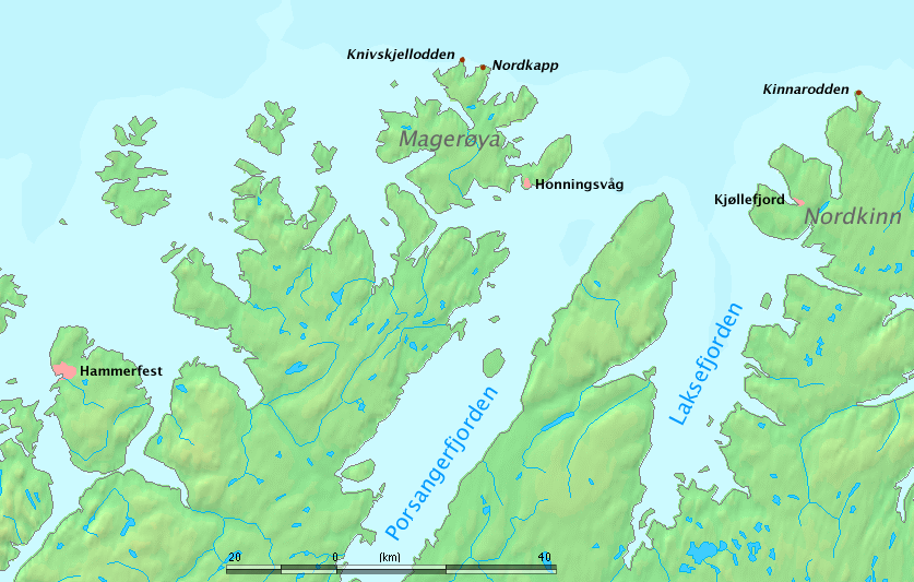
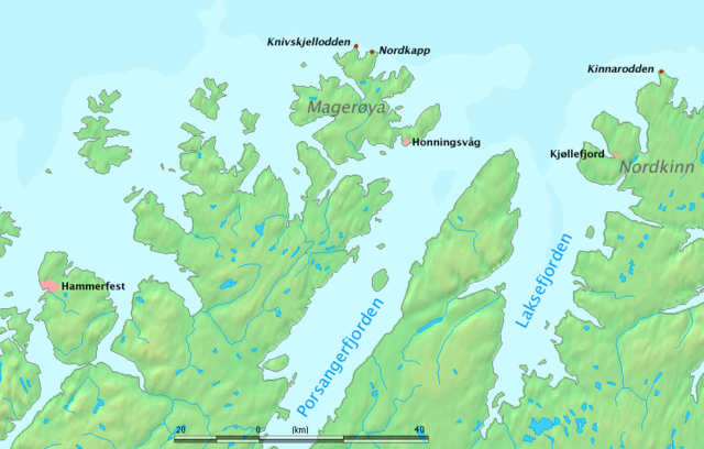
Map of North Cape region, Norway.
The map shows Nordkapp, Kinnarodden (northernmost point of mainland Europe, located on Nordkinn peninsula) and Knivskjellodden (northernmost point of Europe, located on the island of Magerøya).
Work by Markus Bernet, background map courtesy of www.demis.nl[dead link].
This image is in the public domain because it came from the site https://www.demis.nl/products/web-map-server/examples/ and was released by the copyright holder. Permission is granted to copy, distribute and/or modify this map since it is based on free of copyright images from: www.demis.nl. See also approval email on de.wp and its clarification.
|
| This work has been released into the public domain by its copyright holder, www.demis.nl. This applies worldwide. In some countries this may not be legally possible; if so: www.demis.nl grants anyone the right to use this work for any purpose, without any conditions, unless such conditions are required by law.
|
Faila hronoloģija
Uzklikšķini uz datums/laiks kolonnā esošās saites, lai apskatītos, kā šis fails izskatījās tad.
| Datums/Laiks | Attēls | Izmēri | Dalībnieks | Komentārs | |
|---|---|---|---|---|---|
| tagadējais | 2006. gada 26. marts, plkst. 14.45 | | 837 × 533 (400 KB) | MRB | Map of North Cape region, Norway. The map shows '''Nordkapp''', '''Kinnarodden''' (northernmost point of ''mainland'' Europe, located on Nordkinn peninsula) and '''Knivskjellodden''' (northernmost point of Europe, located on the island of Magerøya). W |
Faila lietojums
Šo failu neizmanto nevienā lapā.
Globālais faila lietojums
Šīs Vikipēdijas izmanto šo failu:
- Izmantojums az.wikipedia.org
- Izmantojums bg.wikipedia.org
- Izmantojums cy.wikipedia.org
- Izmantojums da.wikipedia.org
- Izmantojums de.wikipedia.org
- Izmantojums de.wiktionary.org
- Izmantojums el.wikipedia.org
- Izmantojums en.wikipedia.org
- Izmantojums es.wikipedia.org
- Izmantojums et.wikipedia.org
- Izmantojums fa.wikipedia.org
- Izmantojums fi.wikipedia.org
- Izmantojums fr.wikipedia.org
- Izmantojums fy.wikipedia.org
- Izmantojums gl.wikipedia.org
- Izmantojums he.wikipedia.org
- Izmantojums hr.wikipedia.org
- Izmantojums hu.wikipedia.org
- Izmantojums it.wikipedia.org
- Izmantojums kw.wikipedia.org
- Izmantojums nl.wikipedia.org
Skatīt šī faila pilno globālo izmantojumu.