Attēls:Location map Washington, D.C. central.png
Augstāka izšķirtspēja nav pieejama.
Location_map_Washington,_D.C._central.png (627 × 599 pikseļi, faila izmērs: 218 KB, MIME tips: image/png)
| Šis fails ir no Vikikrātuves. Tā apraksts no attēla lapas Vikikrātuvē ir parādīts zemāk. Vikikrātuve ir brīvi licencēta failu krātuve. Tu vari tai palīdzēt. |

|
This city map image could be re-created using vector graphics as an SVG file. This has several advantages; see Commons:Media for cleanup for more information. If an SVG form of this image is available, please upload it and afterwards replace this template with
{{vector version available|new image name}}.
It is recommended to name the SVG file “Location map Washington, D.C. central.svg”—then the template Vector version available (or Vva) does not need the new image name parameter. |
| Apraksts |
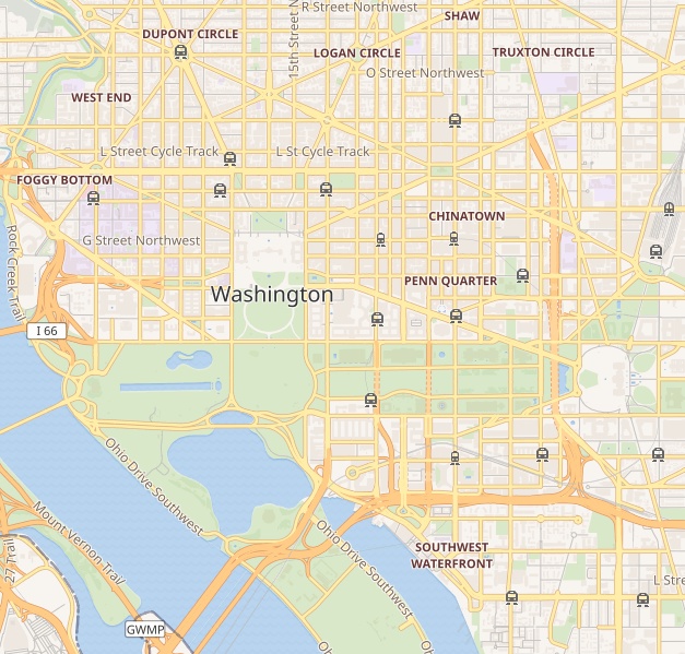
This map of Washington D.C. was created from OpenStreetMap project data, collected by the community. This map may be incomplete, and may contain errors. Don't rely solely on it for navigation. |
|||||||||
| Datums | (see file history) | |||||||||
| Avots | openstreetmap.org | |||||||||
| Izveidotājs |
OpenStreetMap contributors |
|||||||||
| Atļauja: (Šī faila izmantošana citur) |
OpenStreetMap data and maps are licensed under the Creative Commons Attribution-ShareAlike 2.0 license (CC-BY-SA 2.0). Šis fails tiek izplatīts saskaņā ar licences Creative Commons Atsauce-Līdzīgi Noteikumi 2.0 Vispārējiem noteikumiem.
|
|||||||||
| Geotemporal data | ||||||||||
| Bounding box |
|
|||||||||
| Georeferencing | If inappropriate please set warp_status = skip to hide. | |||||||||
Faila hronoloģija
Uzklikšķini uz datums/laiks kolonnā esošās saites, lai apskatītos, kā šis fails izskatījās tad.
| Datums/Laiks | Attēls | Izmēri | Dalībnieks | Komentārs | |
|---|---|---|---|---|---|
| tagadējais | 2018. gada 8. septembris, plkst. 23.41 | | 627 × 599 (218 KB) | LinkTiger | Get same image from Wikimedia's map server: https://maps.wikimedia.org/img/osm-intl,14,38.893,-77.03075,627x599.png It's still bad, but maybe not quite as bad? |
| 2016. gada 21. aprīlis, plkst. 16.23 |  | 796 × 761 (713 KB) | LinkTiger | Use latest OpenStreetMap style, which includes GSoC road visibility updates | |
| 2013. gada 6. novembris, plkst. 11.33 |  | 796 × 761 (662 KB) | Ebywan | Update to current OpenStreetMap data | |
| 2010. gada 26. maijs, plkst. 21.34 |  | 796 × 761 (579 KB) | Dr. Blofeld~commonswiki | {{Information |Description={{en|1=j}} |Source=j |Author=j |Date=j |Permission= |other_versions= }} |
Faila lietojums
Šo failu izmanto šajās 10 lapās:
Globālais faila lietojums
Šīs Vikipēdijas izmanto šo failu:
- Izmantojums ar.wikipedia.org
- Izmantojums bh.wikipedia.org
- Izmantojums bn.wikipedia.org
- Izmantojums ceb.wikipedia.org
- Izmantojums ce.wikipedia.org
- Izmantojums en.wikipedia.org
- United States Capitol
- Vietnam Veterans Memorial
- White House
- National Academies of Sciences, Engineering, and Medicine
- Lincoln Memorial
- Washington Monument
- National Air and Space Museum
- Hart Senate Office Building
- Jefferson Memorial
- John F. Kennedy Center for the Performing Arts
- Franklin Delano Roosevelt Memorial
- Ford's Theatre
- Korean War Veterans Memorial
- World War II Memorial
- United States Holocaust Memorial Museum
- Watergate complex
- Ronald Reagan Building and International Trade Center
- George Mason Memorial
- Russell Senate Office Building
- Cannon House Office Building
- Corcoran Gallery of Art
- Arts and Industries Building
- Willard InterContinental Washington
- International Spy Museum
- Mayflower Hotel
- National Postal Museum
- National Museum of Women in the Arts
- J. Edgar Hoover Building
- Cathedral of St. Matthew the Apostle (Washington, D.C.)
- President's Park
- Dirksen Senate Office Building
- District of Columbia War Memorial
- Washington Circle
- S. Dillon Ripley Center
- Eisenhower Executive Office Building
- National Museum of African Art
- St. John's Episcopal Church, Lafayette Square
- United States Supreme Court Building
Skatīt šī faila pilno globālo izmantojumu.