Attēls:Latium et Campania.png
Sākotnējais fails (1 158 × 822 pikseļi, faila izmērs: 7,38 MB, MIME tips: image/png)
| Šis fails ir no Vikikrātuves. Tā apraksts no attēla lapas Vikikrātuvē ir parādīts zemāk. Vikikrātuve ir brīvi licencēta failu krātuve. Tu vari tai palīdzēt. |
Kopsavilkums
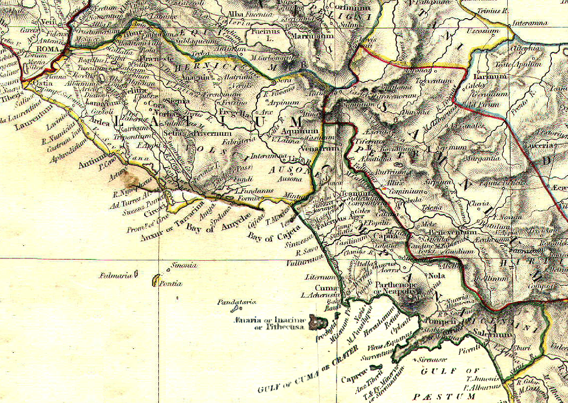
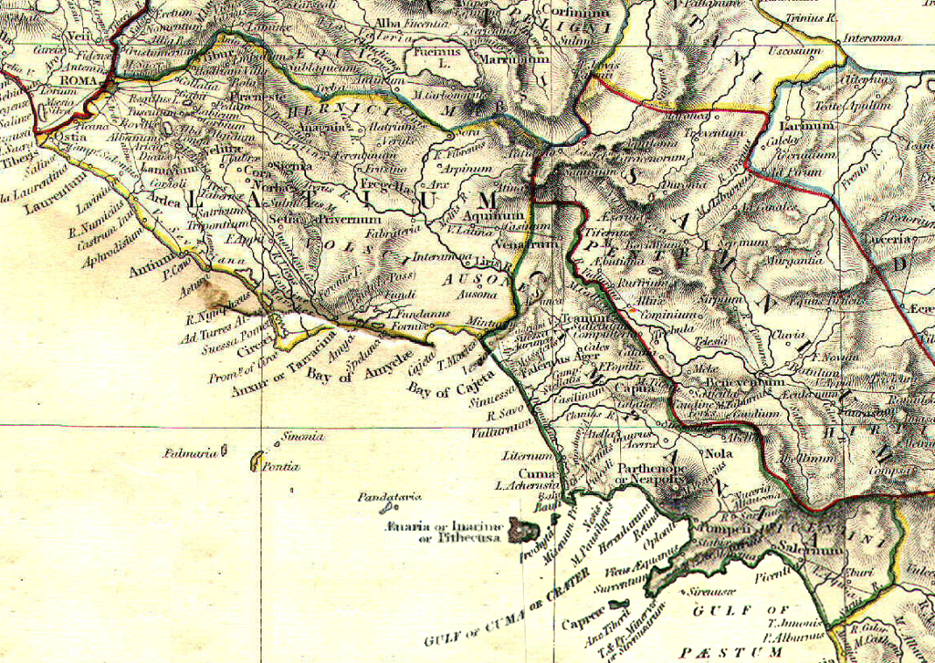
| Apraksts | Reference map for Roman Empire Regium I Latium et Campania | ||||||||||||||||||||||
| Datums | |||||||||||||||||||||||
| Avots | The Historical Atlas by William R. Shepherd, 1911 | ||||||||||||||||||||||
| Autors |
|
||||||||||||||||||||||
| Atļauja: (Šī faila izmantošana citur) |
public domain because its copyright has expired | ||||||||||||||||||||||
Licence
|
This work is in the public domain in its country of origin and other countries and areas where the copyright term is the author's life plus 70 years or fewer.
| |
| This file has been identified as being free of known restrictions under copyright law, including all related and neighboring rights. | |
Faila hronoloģija
Uzklikšķini uz datums/laiks kolonnā esošās saites, lai apskatītos, kā šis fails izskatījās tad.
| Datums/Laiks | Attēls | Izmēri | Dalībnieks | Komentārs | |
|---|---|---|---|---|---|
| tagadējais | 2008. gada 1. maijs, plkst. 15.06 | | 1 158 × 822 (7,38 MB) | GlióPanteco | {{Information |Description=Reference map for Roman Empire Regium I Latium et Campania |Source=''The Historical Atlas'' by William R. Shepherd, 1911 |Date=May 1st 2008 |Author=William R. Shepherd |Permission=public domain because its copyright has expired |
Faila lietojums
Šo failu izmanto šajā 1 lapā:
Globālais faila lietojums
Šīs Vikipēdijas izmanto šo failu:
- Izmantojums ar.wikipedia.org
- Izmantojums bg.wikipedia.org
- Izmantojums da.wikipedia.org
- Izmantojums en.wikipedia.org
- Izmantojums es.wikipedia.org
- Izmantojums et.wikipedia.org
- Izmantojums fi.wikipedia.org
- Izmantojums fr.wikipedia.org
- Izmantojums id.wikipedia.org
- Izmantojums it.wikipedia.org
- Napoli
- Sperlonga
- Calvi Risorta
- Alatri
- Anagni
- Aquino
- Arpino
- Atina
- Trevi nel Lazio
- Cori
- Priverno
- Sezze
- Castel Volturno
- Cales
- Ariccia
- Lanuvio
- Palestrina
- Velletri
- Cuma
- Atella (città antica)
- Capua (città antica)
- Roma (città antica)
- Gaeta
- Forum Appii
- Bovillae
- Oplontis
- Giugliano in Campania
- Terracina
- Nuceria Alfaterna
- Stabia
- Avella
- Vescia (città)
- Pentapoli aurunca
- Lavinio (città antica)
- Ceccano
- Crustumerium
- Miseno (Bacoli)
Skatīt šī faila pilno globālo izmantojumu.