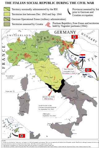
Attēls:Italian-social-republic-and-civil-war.svg

Sākotnējais fails (SVG fails, definētais izmērs 1 000 × 1 500 pikseļi, faila izmērs: 850 KB)
| Šis fails ir no Vikikrātuves. Tā apraksts no attēla lapas Vikikrātuvē ir parādīts zemāk. Vikikrātuve ir brīvi licencēta failu krātuve. Tu vari tai palīdzēt. |
Kopsavilkums
| Apraksts |
English: Map of Italy during the Civil War, focusing on the Italian Social Republic Italiano: Carta dell'Italia durante la Guerra Civile con particolare attenzione alla Repubblica Sociale Italiana |
| Datums | |
| Avots |
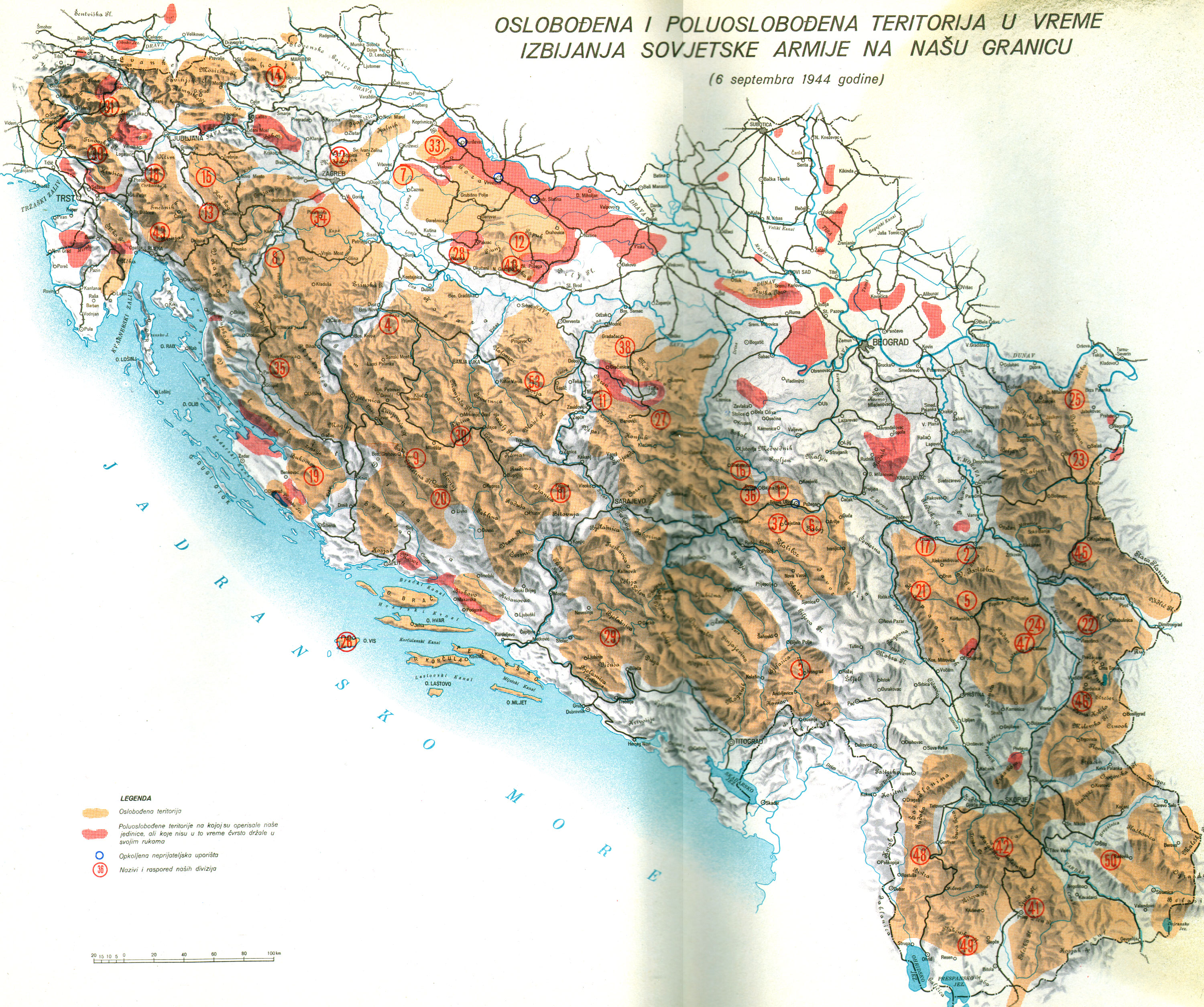
Paša darbs - Bibliography: Atlante storico della Resistenza italiana by L. Baldissara, Bruno Mondadori, 2000; Storia della Guerra Civile in Italia 1943-1945 by Giorgio Pisanò, FPE, 1965-'67; Breve storia della Resistenza Italiana, FIVL, Edizioni Civitas, 1990. About OZAK: Salò-Berlino, l'alleanza difficile by Nicola Cospito, Hans W. Neulen, Mursia and this map; about Rome "open city" occupied by Germans and not capital of RSI, Renzo De Felice, Mussolini, l'Alleato. La guerra civile, Einaudi, p. 373. About German and Allies positions in Southern Italy at September 18, 1943: http://www.westpoint.edu/, Harper Collins Atlas of the Second World War, Storia della Seconda guerra mondiale, vol. 4, Rizzoli-Purnell. About the territories held by Yugoslav partisans in Dalmazia and in the Province of Ljubljana see http://upload.wikimedia.org/wikipedia/commons/f/f8/Oslobo%C4%91ena_teritorija_septembra_1944.jpg . About the British-Yugoslav occupation of Lissa (Vis), see: "Chronology and Index of the Second World War, 1938-1945" (The Royal Institute of International Affairs) and "Tito, Mihailović, and the Allies, 1941-1945" (Walter R. Roberts). About the names of cities see http://images.nationmaster.com/images/motw/historical/italy_1921.jpg Original map realized for the congress “Agricoltura e vita quotidiana nella RSI” (Salò, Italy, October 2004) - new version updated and remedied on Storia in Rete n. 49-50 (released in CC 3.0 SA by). |
| Autors | Emanuele Mastrangelo |
| Citas versijas |
[]
|


Licence
- Jūs varat brīvi:
- koplietot – kopēt, izplatīt un pārraidīt darbu
- remiksēt – pielāgot darbu
- Saskaņā ar šādiem nosacījumiem:
- atsaucoties – Tev ir jānorāda autors, saite uz licenci un to, vai veiktas kādas izmaiņas. To var darīt jebkādā saprātīgā veidā, bet ne tādā, kas norādītu, ka licencētājs atbalsta tevi vai veidu, kā tu izmanto šo darbu.
- nemainot licenci – Ja tu miksē, pārveido vai izmanto materiālu, tev savs devums jāpublicē ar to pašu vai saderīgu licenci kā oriģināls.

|
Legal disclaimer This image shows (or resembles) a symbol that was used by the National Socialist (NSDAP/Nazi) government of Germany or an organization closely associated to it, or another party which has been banned by the Federal Constitutional Court of Germany. The use of insignia of organizations that have been banned in Germany (like the Nazi swastika or the arrow cross) may also be illegal in Austria, Hungary, Poland, Czech Republic, France, Brazil, Israel, Ukraine, Russia and other countries, depending on context. In Germany, the applicable law is paragraph 86a of the criminal code (StGB), in Poland – Art. 256 of the criminal code (Dz.U. 1997 nr 88 poz. 553). |
Faila hronoloģija
Uzklikšķini uz datums/laiks kolonnā esošās saites, lai apskatītos, kā šis fails izskatījās tad.
| Datums/Laiks | Attēls | Izmēri | Dalībnieks | Komentārs | |
|---|---|---|---|---|---|
| tagadējais | 2021. gada 8. decembris, plkst. 12.48 | | 1 000 × 1 500 (850 KB) | Andrei Stroe | File uploaded using svgtranslate tool (https://svgtranslate.toolforge.org/). Added translation for ro. |
| 2015. gada 1. aprīlis, plkst. 19.18 |  | 1 000 × 1 500 (832 KB) | NikNaks | Reverted to version as of 16:30, 31 March 2015 | |
| 2015. gada 31. marts, plkst. 20.27 |  | 1 000 × 1 500 (802 KB) | NikNaks | replace fortifications with text Vs | |
| 2015. gada 31. marts, plkst. 19.30 |  | 1 000 × 1 500 (832 KB) | P. S. Burton | ||
| 2015. gada 31. marts, plkst. 19.28 |  | 1 000 × 1 500 (832 KB) | P. S. Burton | ||
| 2015. gada 31. marts, plkst. 19.26 |  | 1 000 × 1 500 (832 KB) | P. S. Burton | trying again | |
| 2015. gada 31. marts, plkst. 19.22 |  | 1 000 × 1 500 (832 KB) | P. S. Burton | text corrections | |
| 2015. gada 31. marts, plkst. 18.55 |  | 1 000 × 1 500 (832 KB) | NikNaks | simplified circle pattern | |
| 2015. gada 31. marts, plkst. 18.30 |  | 1 000 × 1 500 (840 KB) | NikNaks | error in striped area | |
| 2015. gada 31. marts, plkst. 00.24 |  | 1 000 × 1 500 (882 KB) | NikNaks | size of "FRANCE" fixed |
Faila lietojums
Šo failu izmanto šajā 1 lapā:
Globālais faila lietojums
Šīs Vikipēdijas izmanto šo failu:
- Izmantojums ar.wikipedia.org
- Izmantojums bg.wikipedia.org
- Izmantojums de.wikipedia.org
- Izmantojums el.wikipedia.org
- Izmantojums en.wikipedia.org
- Izmantojums fa.wikipedia.org
- Izmantojums fr.wikipedia.org
- Izmantojums he.wikipedia.org
- Izmantojums hr.wikipedia.org
- Izmantojums id.wikipedia.org
- Izmantojums it.wikipedia.org
- Izmantojums ja.wikipedia.org
- Izmantojums ko.wikipedia.org
- Izmantojums mk.wikipedia.org
- Izmantojums no.wikipedia.org
- Izmantojums pt.wikipedia.org
- Izmantojums ro.wikipedia.org
- Izmantojums sc.wikipedia.org
- Izmantojums sh.wikipedia.org
- Izmantojums tr.wikipedia.org
- Izmantojums www.wikidata.org
- Izmantojums zh.wikipedia.org