Attēls:Cotedazur.png
Šī priekšskata izmērs: 800 × 498 pikseļi. Citi izmēri: 320 × 199 pikseļi | 640 × 398 pikseļi | 826 × 514 pikseļi.
Sākotnējais fails (826 × 514 pikseļi, faila izmērs: 453 KB, MIME tips: image/png)
| Šis fails ir no Vikikrātuves. Tā apraksts no attēla lapas Vikikrātuvē ir parādīts zemāk. Vikikrātuve ir brīvi licencēta failu krātuve. Tu vari tai palīdzēt. |
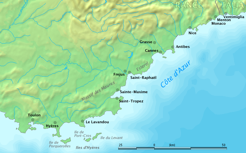
Map of Côte d'Azur, France
Original work by Markus Bernet, background map courtesy of www.demis.nl[dead link].

|
This file has been superseded by Côte d’Azur overview map.png. It is recommended to use the other file. Please note that deleting superseded images requires consent.
|

|
This image is in the public domain because it came from the site https://www.demis.nl/products/web-map-server/examples/ and was released by the copyright holder. Permission is granted to copy, distribute and/or modify this map since it is based on free of copyright images from: www.demis.nl. See also approval email on de.wp and its clarification.
|
| This work has been released into the public domain by its copyright holder, www.demis.nl. This applies worldwide. In some countries this may not be legally possible; if so: www.demis.nl grants anyone the right to use this work for any purpose, without any conditions, unless such conditions are required by law.
|
derivative works
Derivative works of this file: Fort de Brégançon location.png
Faila hronoloģija
Uzklikšķini uz datums/laiks kolonnā esošās saites, lai apskatītos, kā šis fails izskatījās tad.
| Datums/Laiks | Attēls | Izmēri | Dalībnieks | Komentārs | |
|---|---|---|---|---|---|
| tagadējais | 2006. gada 28. marts, plkst. 12.32 | | 826 × 514 (453 KB) | MRB | Map of ''Côte d'Azur'', France Original work by Markus Bernet, background map courtesy of [http://www.demis.nl/mapserver/mapper.asp www.demis.nl]. {{Demis-pd}} |
Faila lietojums
Šo failu neizmanto nevienā lapā.
Globālais faila lietojums
Šīs Vikipēdijas izmanto šo failu:
- Izmantojums ar.wikipedia.org
- Izmantojums bg.wikipedia.org
- Izmantojums el.wikipedia.org
- Izmantojums en.wikipedia.org
- Izmantojums fa.wikipedia.org
- Izmantojums fr.wikipedia.org
- Izmantojums uk.wikipedia.org