Attēls:China Xinjiang adm location map.svg

Sākotnējais fails (SVG fails, definētais izmērs 2 220 × 1 939 pikseļi, faila izmērs: 485 KB)
| Šis fails ir no Vikikrātuves. Tā apraksts no attēla lapas Vikikrātuvē ir parādīts zemāk. Vikikrātuve ir brīvi licencēta failu krātuve. Tu vari tai palīdzēt. |
Kopsavilkums
| Apraksts |
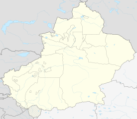
Deutsch: Positionskarte von Xinjiang, Volksrepublik China
English: Location map of Xinjiang, People's Republic of China
|
||||||||||||
| Datums | |||||||||||||
| Avots |
Own work using:
|
||||||||||||
| Autors | NordNordWest | ||||||||||||
| Citas versijas |
|
||||||||||||
| SVG veidošana | This world map was created with Adobe Illustrator.
|
||||||||||||


Licence
Usage of this file with:

explanatory notes: Legally binding is only the full legalcode. For a free usage I recommend to respect the following licence conditions:
1. Provide my name as given above: NordNordWest,
2. a copy of, or the URI for, the applicable license: https://creativecommons.org/licenses/by-sa/3.0/de/legalcode,
3. the title of the work,
4. in the case of an adaptation, a credit identifying the use of the work in the adaptation.
This license and the rights granted hereunder will terminate automatically upon any breach by you of the terms of this license. Any of the above conditions can be waived if you get permission from the copyright holder. If you have questions or wish differing conditions, please contact me through nnwest or my discussion page ![]() t-online.de
t-online.de
- Jūs varat brīvi:
- koplietot – kopēt, izplatīt un pārraidīt darbu
- remiksēt – pielāgot darbu
- Saskaņā ar šādiem nosacījumiem:
- atsaucoties – Tev ir jānorāda autors, saite uz licenci un to, vai veiktas kādas izmaiņas. To var darīt jebkādā saprātīgā veidā, bet ne tādā, kas norādītu, ka licencētājs atbalsta tevi vai veidu, kā tu izmanto šo darbu.
- nemainot licenci – Ja tu miksē, pārveido vai izmanto materiālu, tev savs devums jāpublicē ar to pašu vai saderīgu licenci kā oriģināls.

Faila hronoloģija
Uzklikšķini uz datums/laiks kolonnā esošās saites, lai apskatītos, kā šis fails izskatījās tad.
| Datums/Laiks | Attēls | Izmēri | Dalībnieks | Komentārs | |
|---|---|---|---|---|---|
| tagadējais | 2020. gada 14. februāris, plkst. 23.06 | | 2 220 × 1 939 (485 KB) | NordNordWest | == {{int:filedesc}} == {{Information |Description= {{de|1=Positionskarte von Xinjiang, Volksrepublik China}} {{en|1=Location map of Xinjiang, People's Republic of China}} {{Location map series N |stretching=135 |top=49.4 |bottom=34.2 |left=73.2 |right=96.7 }} |Source={{Own using}} * United States National Imagery and Mapping Agency data * World Data Base II data |Date=2020-02-14 |Author={{U|NordNordWest}} |Permission= |other_versions=<gallery>China Xinjiang rel location map.svg</gallery> }} {... |
Faila lietojums
Šo failu izmanto šajās 6 lapās:
Globālais faila lietojums
Šīs Vikipēdijas izmanto šo failu:
- Izmantojums bn.wikipedia.org
- Izmantojums cdo.wikipedia.org
- Izmantojums cv.wikipedia.org
- Izmantojums de.wikipedia.org
- Izmantojums en.wikipedia.org
- Tashkurgan Tajik Autonomous County
- Shihezi
- Tacheng
- Aral, Xinjiang
- Ürümqi Diwopu International Airport
- Wujiaqu
- Qapqal Xibe Autonomous County
- Burqin County
- Qinggil County
- Jeminay County
- Yumin County
- Shawan, Xinjiang
- Toli County
- Emin County
- Xinhe County, Xinjiang
- Kalpin County
- Awat County
- Baicheng County
- Kargilik County
- Yopurga County
- Makit County
- Ulugqat County
Skatīt šī faila pilno globālo izmantojumu.