Attēls:Baikal-S1999276045323.png

Šī priekšskata izmērs: 800 × 563 pikseļi. Citi izmēri: 320 × 225 pikseļi | 640 × 450 pikseļi | 1 024 × 720 pikseļi | 1 220 × 858 pikseļi.
Sākotnējais fails (1 220 × 858 pikseļi, faila izmērs: 1,9 MB, MIME tips: image/png)
| Šis fails ir no Vikikrātuves. Tā apraksts no attēla lapas Vikikrātuvē ir parādīts zemāk. Vikikrātuve ir brīvi licencēta failu krātuve. Tu vari tai palīdzēt. |
| Apraksts |
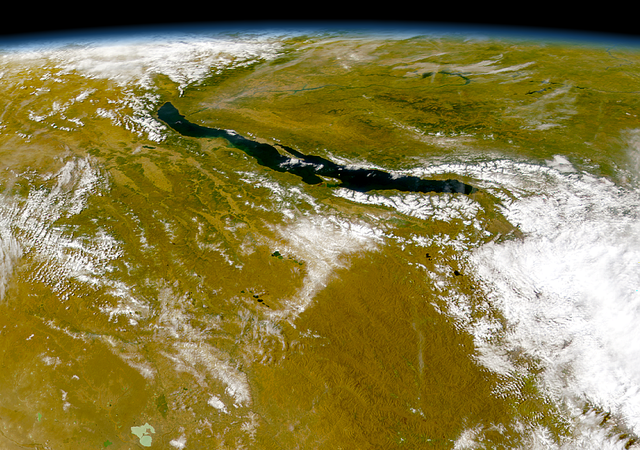
Čeština: Bajkal
|
||||
| Datums | |||||
| Avots | http://visibleearth.nasa.gov/view_rec.php?id=1002 - http://visibleearth.nasa.gov/images/1002/S1999276045323.png | ||||
| Autors | Provided by the SeaWiFS Project, NASA/Goddard Space Flight Center, and ORBIMAGE | ||||
| Atļauja: (Šī faila izmantošana citur) |
|
Faila hronoloģija
Uzklikšķini uz datums/laiks kolonnā esošās saites, lai apskatītos, kā šis fails izskatījās tad.
| Datums/Laiks | Attēls | Izmēri | Dalībnieks | Komentārs | |
|---|---|---|---|---|---|
| tagadējais | 2005. gada 21. jūlijs, plkst. 06.57 | | 1 220 × 858 (1,9 MB) | Bdk | Lake Baikal *Source: http://visibleearth.nasa.gov/view_rec.php?id=1002 - http://visibleearth.nasa.gov/images/1002/S1999276045323.png *Sensor OrbView-2/SeaWiFS *Dates: Datastart 1999-10-03 - Visualization Date 1999-10-03 *Visible Earth v1 ID 3678 *Credit: |
Faila lietojums
Šo failu izmanto šajā 1 lapā:
Globālais faila lietojums
Šīs Vikipēdijas izmanto šo failu:
- Izmantojums arz.wikipedia.org
- Izmantojums ast.wikipedia.org
- Izmantojums as.wikipedia.org
- Izmantojums az.wikipedia.org
- Izmantojums be.wikipedia.org
- Izmantojums ca.wikipedia.org
- Izmantojums ce.wikipedia.org
- Izmantojums crh.wikipedia.org
- Izmantojums cs.wikipedia.org
- Izmantojums cy.wikipedia.org
- Izmantojums de.wikipedia.org
- Izmantojums de.wikivoyage.org
- Izmantojums de.wiktionary.org
- Izmantojums diq.wikipedia.org
- Izmantojums el.wikipedia.org
- Izmantojums en.wikipedia.org
- Izmantojums eo.wikipedia.org
- Izmantojums es.wikipedia.org
- Izmantojums eu.wikipedia.org
- Izmantojums fa.wikipedia.org
- Izmantojums fr.wikivoyage.org
- Izmantojums ga.wikipedia.org
- Izmantojums he.wikipedia.org
- Izmantojums hr.wikipedia.org
- Izmantojums hu.wikipedia.org
- Izmantojums hy.wikipedia.org
- Izmantojums it.wikipedia.org
- Izmantojums ja.wikipedia.org
- Izmantojums ka.wikipedia.org
- Izmantojums kbp.wikipedia.org
- Izmantojums kk.wikipedia.org
- Izmantojums lb.wikipedia.org
- Izmantojums lmo.wikipedia.org
- Izmantojums mhr.wikipedia.org
- Izmantojums myv.wikipedia.org
- Izmantojums my.wikipedia.org
- Izmantojums mzn.wikipedia.org
- Izmantojums nn.wikipedia.org
- Izmantojums no.wikipedia.org
Skatīt šī faila pilno globālo izmantojumu.