Attēls:Antarctica (3), Adelaide Island, Wormald Ice Piedmont.JPG
Šī priekšskata izmērs: 800 × 531 pikseļi. Citi izmēri: 320 × 213 pikseļi | 640 × 425 pikseļi | 1 024 × 680 pikseļi | 1 280 × 850 pikseļi | 1 716 × 1 140 pikseļi.
Sākotnējais fails (1 716 × 1 140 pikseļi, faila izmērs: 408 KB, MIME tips: image/jpeg)
| Šis fails ir no Vikikrātuves. Tā apraksts no attēla lapas Vikikrātuvē ir parādīts zemāk. Vikikrātuve ir brīvi licencēta failu krātuve. Tu vari tai palīdzēt. |
,_Adelaide_Island,_Wormald_Ice_Piedmont.JPG?uselang=lv)
Kopsavilkums
| Apraksts |
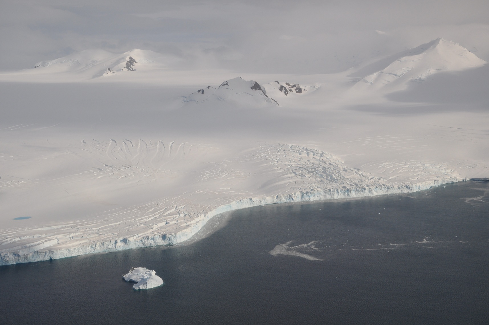
English: The Wormald Ice Piedmont covers large parts of the Wright Peninsula on eastern Adelaide Island, Antarctica, and terminates in high ice cliffs on Laubeuf Fjord. The nunatak in the centre of the picture has a height of 398 m. The mountains on the right form part of the Stokes Peaks and mark the northern edge of the ice piedmont. On the far left a melting pond can be seen on the ice. Viewing direction is toward the NNW. |
| Datums | |
| Avots | Paša darbs |
| Autors | Vincent van Zeijst |
•
| Camera location | | View this and other nearby images on: OpenStreetMap |
|---|
,_Adelaide_Island,_Wormald_Ice_Piedmont.JPG¶ms=-67.500686_N_-068.010864_E_globe:Earth_type:camera_heading:337.50&language=lv)
Licence
Es, šī darba autortiesību īpašnieks, publicēju to saskaņā ar šo licenci:
Šis fails tiek izplatīts saskaņā ar licences Creative Commons Atsauce-Līdzīgi Noteikumi 3.0 Vispārējiem noteikumiem.
- Jūs varat brīvi:
- koplietot – kopēt, izplatīt un pārraidīt darbu
- remiksēt – pielāgot darbu
- Saskaņā ar šādiem nosacījumiem:
- atsaucoties – Tev ir jānorāda autors, saite uz licenci un to, vai veiktas kādas izmaiņas. To var darīt jebkādā saprātīgā veidā, bet ne tādā, kas norādītu, ka licencētājs atbalsta tevi vai veidu, kā tu izmanto šo darbu.
- nemainot licenci – Ja tu miksē, pārveido vai izmanto materiālu, tev savs devums jāpublicē ar to pašu vai saderīgu licenci kā oriģināls.
Faila hronoloģija
Uzklikšķini uz datums/laiks kolonnā esošās saites, lai apskatītos, kā šis fails izskatījās tad.
| Datums/Laiks | Attēls | Izmēri | Dalībnieks | Komentārs | |
|---|---|---|---|---|---|
| tagadējais | 2011. gada 9. marts, plkst. 00.48 | | 1 716 × 1 140 (408 KB) | Loranchet | {{Information |Description ={{en|1=The Wormald Ice Piedmont covers large parts of the Wright Peninsula on eastern Adelaide Island, Antarctica, and terminates in high ice cliffs on Laubeuf Fjord. The nunatak in the centre of the picture has a height of |
Faila lietojums
Šo failu izmanto šajā 1 lapā:
Globālais faila lietojums
Šīs Vikipēdijas izmanto šo failu:
- Izmantojums azb.wikipedia.org
- Izmantojums ceb.wikipedia.org
- Izmantojums de.wikipedia.org
- Izmantojums de.wiktionary.org
- Izmantojums en.wikipedia.org
- Izmantojums fi.wikipedia.org
- Izmantojums he.wikipedia.org
- Izmantojums id.wikipedia.org
- Izmantojums incubator.wikimedia.org
- Izmantojums li.wiktionary.org
- Izmantojums nn.wikipedia.org
- Izmantojums sv.wikipedia.org
- Izmantojums th.wiktionary.org
- Izmantojums www.wikidata.org
- Izmantojums zh.wikipedia.org
,_Adelaide_Island,_Wormald_Ice_Piedmont.JPG)