Attēls:PRVSSIA1576Casparo Henneberg.png
Šī priekšskata izmērs: 779 × 600 pikseļi. Citi izmēri: 312 × 240 pikseļi | 624 × 480 pikseļi | 998 × 768 pikseļi | 1 280 × 986 pikseļi | 2 560 × 1 971 pikseļi | 2 973 × 2 289 pikseļi.
Sākotnējais fails (2 973 × 2 289 pikseļi, faila izmērs: 4,5 MB, MIME tips: image/png)
| Šis fails ir no Vikikrātuves. Tā apraksts no attēla lapas Vikikrātuvē ir parādīts zemāk. Vikikrātuve ir brīvi licencēta failu krātuve. Tu vari tai palīdzēt. |
| Apraksts |
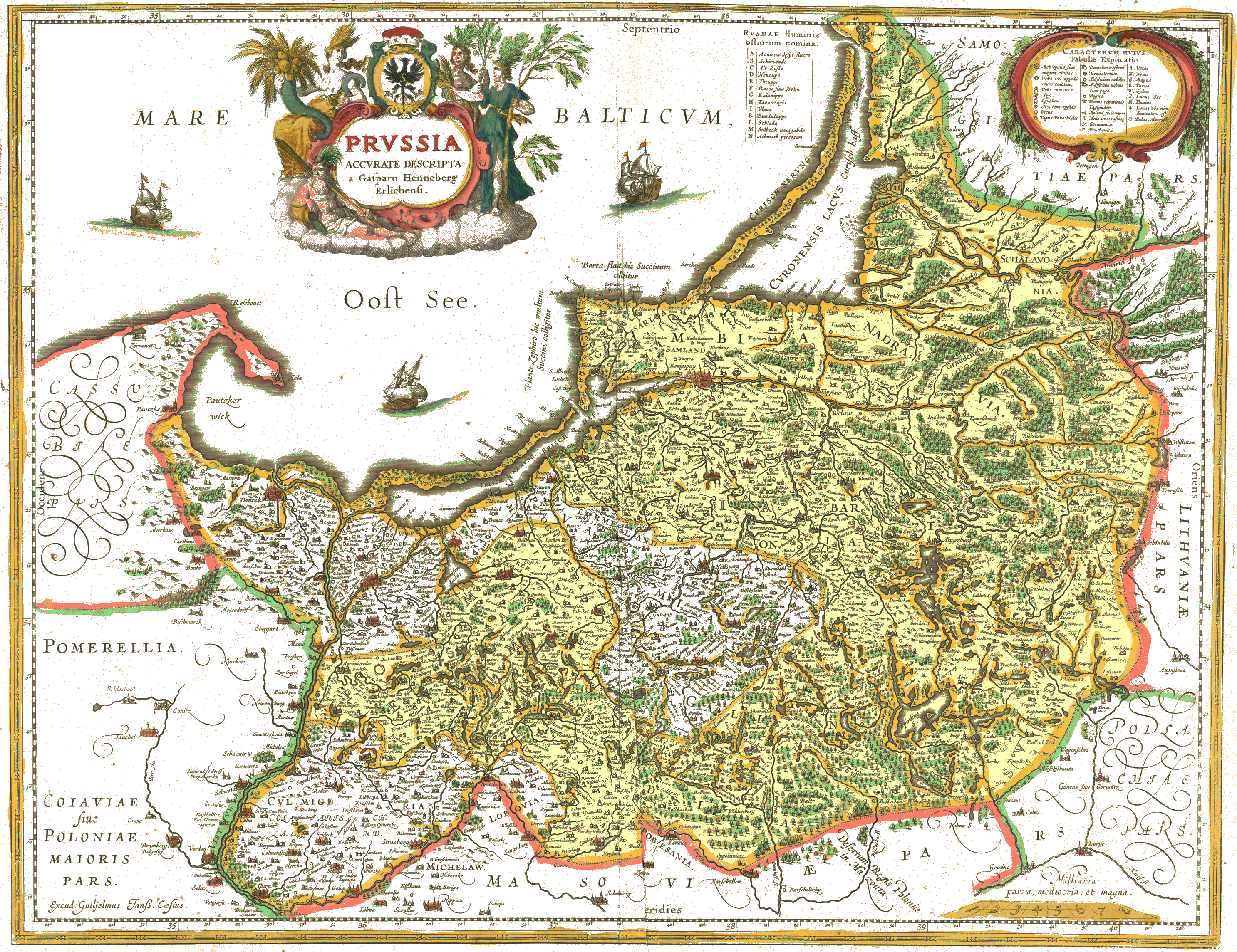
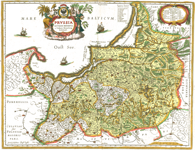
Deutsch: Karte von Preußen, gedruckt von Willem Blaeu im Jahre 1645, nach den 1576 in Elbing gedruckten Holzschnitten von Caspar Henneberg von Erlich (* 1529, † 1600).
Blaeus Druck von 1645 hat farbige Konturbänder aber keine Flächenfarbe. Auffälligkeiten: Die beiden Teile Preußens sind farblich nicht unterschieden, obwohl 1569 der westliche Teil Preußens unter Schirmherrschaft der polnischen Krone gekommen war, und der östliche Teil, das Herzogtum, lehensabhängig war, beide Teile Preußens jedoch per Vertrag eine gemeinsame Grenze gegen die Nachbarländer behielten. Die Nachbargebiete sind in unterschiedlichen Farben umrahmt, obwohl sie zur Rzeczpospolita gehörten. Schließlich ist Pommerellen nicht als Teil Preußens dargestellt, sondern als Teil Großpolens oder Kujawiens. Einige Namen sind zweisprachig angegeben, so "Bramberg / Bedgosky" (Bromberg / Bydgoszcz), oder als Kompromiss wie "Dantzk". English: Map of Prussia before it gave its name to the state of Prussia, printed by Willem Blaeu in 1645. The original woodcuts were printed in Elbląg (at that time Elbing) in 1576 by Caspar Henneberg von Erlich (1529 - 1600). Blaeu's 1645 print has colored outlines but no area coloration. Interesting details: The two fractions of Prussia have the same coloration, though the western (royal Polish Prussia) fractions was in 1569 declared (and contested) as part of the Polish-Lithuanian Rzeczpospolita, while the eastern (ducal) part was only a vassal of the crown (king) of Poland. Both parts of Prussia retained by contracts one common border against neighboring countries. The neighboring territories, all of them parts of the Rzeczpospolita, are marked by different colors. Last not least Pomerella is not shown as a part of Prussia, but as a part of Greater Poland (which was one of the Polish provinces). A few names are noted bilingually, such as "Bramberg / Bedgosky" (Bromberg / Bydgoszcz), or as a compromise like "Dantzk". |
||||||||||||||||
| Datums | |||||||||||||||||
| Avots | Image:Blaeu 1645 - Prussia.jpg | ||||||||||||||||
| Autors |
|
||||||||||||||||
| Atļauja: (Šī faila izmantošana citur) |
Deutsch: Diese Version wurde in folgender Weise bearbeitet: Entfernt wurden die Vergilbung des Papiers und, so gut es ging, der Schattenwurf von Knitterfalten. Die Farben der Konturbänder wurden aufgefrischt ohne ihre Lokalisation zu verändern. Weil die als schwarze Punktreihe markierte Grenze zwischen Herzoglichem und Königlichem Preußen in derselben Farbe hervorgehoben ist wie einige Gewässerufer des Landes und die Hervorhebung als Grenze entlang des Flusses Sorge fehlt, wurde das herzogliche Preußen in der Bearbeitung mit einer blassgelben Flächenfarbe hervorgehoben. Die nachträgliche farbliche Hervorhebung der Grenze in der Region "Lubuvia", Stadt "Lobaw" ist fehlerhaft. Die Grenzziehung muss wieter östlich erfolgen, sehe gepunktete Linie Nähe "Lewalde", "Gilgenaw" in orginal ohne nachträgliche farbliche Hervorhebung |
||||||||||||||||
|
This is a faithful photographic reproduction of a two-dimensional, public domain work of art. The work of art itself is in the public domain for the following reason:
The official position taken by the Wikimedia Foundation is that "faithful reproductions of two-dimensional public domain works of art are public domain".
This photographic reproduction is therefore also considered to be in the public domain in the United States. In other jurisdictions, re-use of this content may be restricted; see Reuse of PD-Art photographs for details. | ||||
Faila hronoloģija
Uzklikšķini uz datums/laiks kolonnā esošās saites, lai apskatītos, kā šis fails izskatījās tad.
| Datums/Laiks | Attēls | Izmēri | Dalībnieks | Komentārs | |
|---|---|---|---|---|---|
| tagadējais | 2022. gada 14. janvāris, plkst. 14.37 | | 2 973 × 2 289 (4,5 MB) | Ulamm | Bisher übersehene Grenzabschnitte bei "Gilgenaw" und "G. Lentzke" berücksichtigt, die die Ostgrenze des zum Königlich polnischen Preußen gehörenden "Lobovia" markieren. |
| 2017. gada 5. maijs, plkst. 23.01 |  | 2 973 × 2 289 (7,05 MB) | SteinsplitterBot | Bot: Image rotated by 270° | |
| 2017. gada 4. maijs, plkst. 17.00 |  | 2 289 × 2 973 (7,32 MB) | SteinsplitterBot | Bot: Image rotated by 90° | |
| 2007. gada 28. decembris, plkst. 20.41 |  | 2 973 × 2 289 (4,45 MB) | Ulamm | ||
| 2007. gada 28. decembris, plkst. 19.55 |  | 2 973 × 2 289 (4,5 MB) | Ulamm | ||
| 2007. gada 28. decembris, plkst. 19.50 |  | 2 973 × 2 289 (4,5 MB) | Ulamm | ||
| 2007. gada 28. decembris, plkst. 19.47 |  | 2 973 × 2 289 (4,53 MB) | Ulamm | {{Information |Description = {{de}} Karte von Preußen, erstellt 1576 in Elbing von Carpar Henneberg von Erlich (* 1529, † 1600), später von anderen Kartografen weiterbenutzt, u.a. de:Blaeu. Im Original gibt es farbige Kon |
Faila lietojums
Šo failu izmanto šajās 2 lapās:
Globālais faila lietojums
Šīs Vikipēdijas izmanto šo failu:
- Izmantojums ar.wikipedia.org
- Izmantojums arz.wikipedia.org
- Izmantojums bg.wikipedia.org
- Izmantojums csb.wikipedia.org
- Izmantojums de.wikipedia.org
- Izmantojums el.wikipedia.org
- Izmantojums en.wikipedia.org
- Izmantojums eo.wikipedia.org
- Izmantojums es.wikipedia.org
- Izmantojums et.wikipedia.org
- Izmantojums fr.wikipedia.org
- Izmantojums hu.wikipedia.org
- Izmantojums it.wikipedia.org
- Izmantojums ja.wikipedia.org
- Izmantojums lt.wikipedia.org
- Izmantojums lt.wikibooks.org
- Izmantojums nds.wikipedia.org
- Izmantojums nl.wikipedia.org
- Izmantojums pl.wikipedia.org
- Izmantojums pl.wiktionary.org
Skatīt šī faila pilno globālo izmantojumu.