Attēls:PA 84 quad in Piatt.jpg
Augstāka izšķirtspēja nav pieejama.
PA_84_quad_in_Piatt.jpg (715 × 509 pikseļi, faila izmērs: 116 KB, MIME tips: image/jpeg)
| Šis fails ir no Vikikrātuves. Tā apraksts no attēla lapas Vikikrātuvē ir parādīts zemāk. Vikikrātuve ir brīvi licencēta failu krātuve. Tu vari tai palīdzēt. |
Kopsavilkums
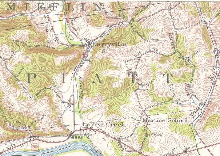
| Apraksts | A United States Geological Survey Topographic Quadrangle marking the southernmost stretch of Pennsylvania Route 84 (now Pennsylvania Route 287) from Larrysville to Larrys Creek in 1953. |
| Datums | |
| Avots | Williamsport NW quadrangle |
| Autors | United States Geological Survey |
Licence
This image is in the public domain in the United States because it only contains materials that originally came from the United States Geological Survey, an agency of the United States Department of the Interior. For more information, see the official USGS copyright policy.
|
Faila hronoloģija
Uzklikšķini uz datums/laiks kolonnā esošās saites, lai apskatītos, kā šis fails izskatījās tad.
| Datums/Laiks | Attēls | Izmēri | Dalībnieks | Komentārs | |
|---|---|---|---|---|---|
| tagadējais | 2009. gada 22. jūlijs, plkst. 15.43 | | 715 × 509 (116 KB) | Mitchazenia | {{Information |Description=A United States Geological Survey Topographic Quadrangle marking the southernmost stretch of Pennsylvania Route 84 (now Pennsylvania Route 287) from Larrysville to Larrys Creek in 1953. |Source=[http://historical.mytopo.com/getI |
Faila lietojums
Šo failu izmanto šajā 1 lapā:
Globālais faila lietojums
Šīs Vikipēdijas izmanto šo failu:
- Izmantojums en.wikipedia.org